

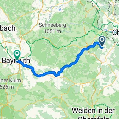
1 D/Waldsassen-CZ/Nejdek-Kühberg
A cycling route starting in Waldsassen, Bavaria, Germany.
Overview
About this route
D/Waldsassen** (477m) - CZ/Cheb* (459m) (Eger) - Kacerov (Katzengrün) - Krajková (Gossengrün) - Rotava (Rothau, 563m) - Nejdek (Neudeck, 568m) - Pernink (Bärringen)-Abertamy (Abertham) - D-Oberwiesenthal**(914m)-Bärenstein-Kühberg (712m)
Landschaftlich sehr abwechslungsreich. Straßen in CZ manchmal löchrig und unter Ausbesserung.
<span style="font-size: 10pt;"> </span>
- -:--
- Duration
- 102.6 km
- Distance
- 1,610 m
- Ascent
- 1,365 m
- Descent
- ---
- Avg. speed
- 1,082 m
- Max. altitude

Route quality
Waytypes & surfaces along the route
Waytypes
Road
55.4 km
(54 %)
Quiet road
3.1 km
(3 %)
Surfaces
Paved
38 km
(37 %)
Asphalt
38 km
(37 %)
Undefined
64.7 km
(63 %)
Continue with Bikemap
Use, edit, or download this cycling route
You would like to ride 1 D/Waldsassen-CZ/Nejdek-Kühberg or customize it for your own trip? Here is what you can do with this Bikemap route:
Free features
- Save this route as favorite or in collections
- Copy & plan your own version of this route
- Split it into stages to create a multi-day tour
- Sync your route with Garmin or Wahoo
Premium features
Free trial for 3 days, or one-time payment. More about Bikemap Premium.
- Navigate this route on iOS & Android
- Export a GPX / KML file of this route
- Create your custom printout (try it for free)
- Download this route for offline navigation
Discover more Premium features.
Get Bikemap PremiumFrom our community
Other popular routes starting in Waldsassen
 Kleine Heimtarunde
- Distance
- 32 km
- Ascent
- 437 m
- Descent
- 438 m
- Location
- Waldsassen, Bavaria, Germany
 Egerer Stausee
- Distance
- 39.7 km
- Ascent
- 228 m
- Descent
- 230 m
- Location
- Waldsassen, Bavaria, Germany
 Rund um Waldsassen
- Distance
- 25.5 km
- Ascent
- 250 m
- Descent
- 246 m
- Location
- Waldsassen, Bavaria, Germany
 2. Teil Furth i.Wald - Cossebaude
- Distance
- 133.9 km
- Ascent
- 1,768 m
- Descent
- 1,699 m
- Location
- Waldsassen, Bavaria, Germany
 KonersreutBürgerreut
- Distance
- 71.4 km
- Ascent
- 343 m
- Descent
- 590 m
- Location
- Waldsassen, Bavaria, Germany
 4. Tag Waldsassen-Königsfeld
- Distance
- 108.8 km
- Ascent
- 800 m
- Descent
- 829 m
- Location
- Waldsassen, Bavaria, Germany
 Egergrabenradweg EGW
- Distance
- 79.2 km
- Ascent
- ---
- Descent
- ---
- Location
- Waldsassen, Bavaria, Germany
 Wallensteinradweg - Mühlenradweg
- Distance
- 62.1 km
- Ascent
- 636 m
- Descent
- 623 m
- Location
- Waldsassen, Bavaria, Germany
Open it in the app