
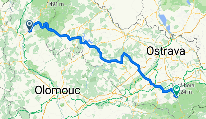
6 CZ/Sumperk - CZ/Frýdlant nad Ostravicí
A cycling route starting in Šumperk, Olomoucký kraj, Czechia.
Overview
About this route
CZ/Sumperk* (Mährisch Schönberg, 315 m) - (Hanusoviká vrochovina = Hannsdorfer Bergland) - Sobotin (Zöptau, 365m) - Rýmarov (Römerstadt, 590m) - Bridlicna (Friedland, 535m) - Bílcice - Vítkov (Wigstadt, 480m) - Skripov - Bílovec (Wagstadt, 243m) - Pribor** (Freiberg in Mähren, 278m) - CZ/Frýdlant nad Ostravicí (Friedland an der Ostrawitza, 357m)
Anstrengende Tour mit über 2.000 Höhenmetern! Da Straßenbau am Werk war, mussten wir Umleitungen fahren und kamen auf 177 km! Auch hier sehenswerte Regionen.
- -:--
- Duration
- 162.8 km
- Distance
- 2,105 m
- Ascent
- 2,030 m
- Descent
- ---
- Avg. speed
- 905 m
- Max. altitude

Route quality
Waytypes & surfaces along the route
Waytypes
Busy road
83.7 km
(51 %)
Road
50.6 km
(31 %)
Surfaces
Paved
66.8 km
(41 %)
Unpaved
1.1 km
(<1 %)
Asphalt
61.9 km
(38 %)
Paving stones
3.1 km
(2 %)
Continue with Bikemap
Use, edit, or download this cycling route
You would like to ride 6 CZ/Sumperk - CZ/Frýdlant nad Ostravicí or customize it for your own trip? Here is what you can do with this Bikemap route:
Free features
- Save this route as favorite or in collections
- Copy & plan your own version of this route
- Split it into stages to create a multi-day tour
- Sync your route with Garmin or Wahoo
Premium features
Free trial for 3 days, or one-time payment. More about Bikemap Premium.
- Navigate this route on iOS & Android
- Export a GPX / KML file of this route
- Create your custom printout (try it for free)
- Download this route for offline navigation
Discover more Premium features.
Get Bikemap PremiumFrom our community
Other popular routes starting in Šumperk
 20250524 Šumperk - Olomouc
- Distance
- 71 km
- Ascent
- 497 m
- Descent
- 608 m
- Location
- Šumperk, Olomoucký kraj, Czechia
 fixed VKJ Praděd Dlouhé stráně
- Distance
- 158.8 km
- Ascent
- 2,757 m
- Descent
- 2,759 m
- Location
- Šumperk, Olomoucký kraj, Czechia
 Grand Royal Tour De Jeseníky 2009
- Distance
- 150.8 km
- Ascent
- 3,069 m
- Descent
- 2,576 m
- Location
- Šumperk, Olomoucký kraj, Czechia
 Zewl Fest 2008 - Tour de Jeseníky
- Distance
- 124.1 km
- Ascent
- 1,852 m
- Descent
- 1,850 m
- Location
- Šumperk, Olomoucký kraj, Czechia
 Šumperk-Hrabová-Stavenice-Úsov-Police-Leština-Šumperk
- Distance
- 55.2 km
- Ascent
- 206 m
- Descent
- 206 m
- Location
- Šumperk, Olomoucký kraj, Czechia
 6 CZ/Sumperk - CZ/Frýdlant nad Ostravicí
- Distance
- 162.8 km
- Ascent
- 2,105 m
- Descent
- 2,030 m
- Location
- Šumperk, Olomoucký kraj, Czechia
 MTBackcountry kolem Šumperka
- Distance
- 72.8 km
- Ascent
- 1,515 m
- Descent
- 1,519 m
- Location
- Šumperk, Olomoucký kraj, Czechia
 fixed vkj Rejvíz Zlaté hory
- Distance
- 181.4 km
- Ascent
- 1,957 m
- Descent
- 1,960 m
- Location
- Šumperk, Olomoucký kraj, Czechia
Open it in the app