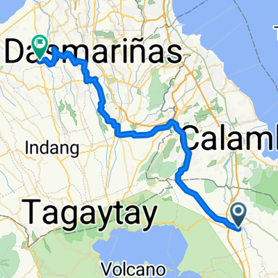
Taal Lake Route
A cycling route starting in Tanauan, Calabarzon, Philippines.
Overview
About this route
110 km ride by the scenic Taal Volcano and Lake, with historical site at the side. A 360 degrees view of Taal Volcano at varying level of sight.
- -:--
- Duration
- 110.4 km
- Distance
- 612 m
- Ascent
- 597 m
- Descent
- ---
- Avg. speed
- ---
- Max. altitude
Continue with Bikemap
Use, edit, or download this cycling route
You would like to ride Taal Lake Route or customize it for your own trip? Here is what you can do with this Bikemap route:
Free features
- Save this route as favorite or in collections
- Copy & plan your own version of this route
- Split it into stages to create a multi-day tour
- Sync your route with Garmin or Wahoo
Premium features
Free trial for 3 days, or one-time payment. More about Bikemap Premium.
- Navigate this route on iOS & Android
- Export a GPX / KML file of this route
- Create your custom printout (try it for free)
- Download this route for offline navigation
Discover more Premium features.
Get Bikemap PremiumFrom our community
Other popular routes starting in Tanauan
- Pan-Philippine Highway 22, Santo Tomas to Chamomile Loop, Tanauan
- Distance
- 14.9 km
- Ascent
- 130 m
- Descent
- 116 m
- Location
- Tanauan, Calabarzon, Philippines
- San Pedro-Suloc-Bansulan Hills-Alaminos-San Pedro
- Distance
- 34 km
- Ascent
- 285 m
- Descent
- 283 m
- Location
- Tanauan, Calabarzon, Philippines
- Route from President Jose P. Laurel Highway 17, Tanauan
- Distance
- 62.1 km
- Ascent
- 871 m
- Descent
- 730 m
- Location
- Tanauan, Calabarzon, Philippines
- Relaxed route in Biñan
- Distance
- 40.7 km
- Ascent
- 1,736 m
- Descent
- 1,878 m
- Location
- Tanauan, Calabarzon, Philippines
- taal loop
- Distance
- 118 km
- Ascent
- 1,659 m
- Descent
- 1,660 m
- Location
- Tanauan, Calabarzon, Philippines
- SV to Bitin to UPLB to Bucal to Saimsim to National Road to Sto. Tomas and back to San Vicente
- Distance
- 50.6 km
- Ascent
- 362 m
- Descent
- 362 m
- Location
- Tanauan, Calabarzon, Philippines
- Tagaytay-Tanauan Ride
- Distance
- 70 km
- Ascent
- 1,393 m
- Descent
- 1,393 m
- Location
- Tanauan, Calabarzon, Philippines
- laguna loop
- Distance
- 201.4 km
- Ascent
- 733 m
- Descent
- 694 m
- Location
- Tanauan, Calabarzon, Philippines
Open it in the app