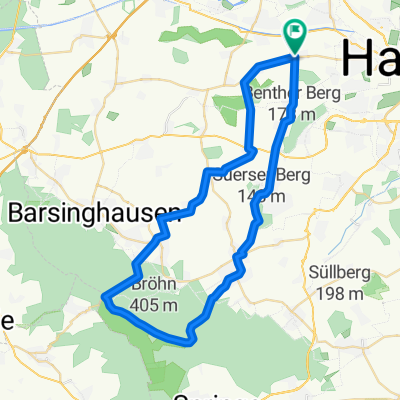
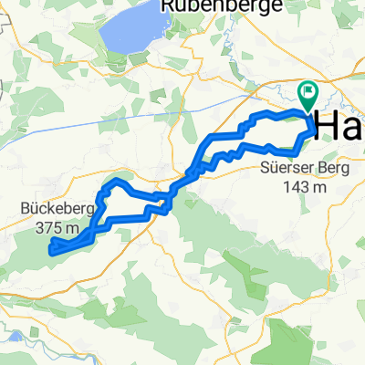
Grüner Ring Hannover mit Flughafenunterquerung
A cycling route starting in Seelze, Lower Saxony, Germany.
Overview
About this route
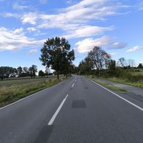
Green Ring Hannover with airport underpass, from Letter train station
- -:--
- Duration
- 86.1 km
- Distance
- 138 m
- Ascent
- 140 m
- Descent
- ---
- Avg. speed
- ---
- Max. altitude
Route quality
Waytypes & surfaces along the route
Waytypes
Track
29.3 km
(34 %)
Path
24.1 km
(28 %)
Surfaces
Paved
49.1 km
(57 %)
Unpaved
28.4 km
(33 %)
Asphalt
44.8 km
(52 %)
Gravel
25.8 km
(30 %)
Continue with Bikemap
Use, edit, or download this cycling route
You would like to ride Grüner Ring Hannover mit Flughafenunterquerung or customize it for your own trip? Here is what you can do with this Bikemap route:
Free features
- Save this route as favorite or in collections
- Copy & plan your own version of this route
- Split it into stages to create a multi-day tour
- Sync your route with Garmin or Wahoo
Premium features
Free trial for 3 days, or one-time payment. More about Bikemap Premium.
- Navigate this route on iOS & Android
- Export a GPX / KML file of this route
- Create your custom printout (try it for free)
- Download this route for offline navigation
Discover more Premium features.
Get Bikemap PremiumFrom our community
Other popular routes starting in Seelze
Seelze - Deister- Distance
- 81.2 km
- Ascent
- 413 m
- Descent
- 413 m
- Location
- Seelze, Lower Saxony, Germany
MTB Herbst-/Winterroute- Distance
- 21.8 km
- Ascent
- 55 m
- Descent
- 52 m
- Location
- Seelze, Lower Saxony, Germany
Grüner Ring Hannover mit Flughafenunterquerung- Distance
- 86.1 km
- Ascent
- 138 m
- Descent
- 140 m
- Location
- Seelze, Lower Saxony, Germany
Hannover - Lindow- Distance
- 303.9 km
- Ascent
- 223 m
- Descent
- 234 m
- Location
- Seelze, Lower Saxony, Germany
Velber - Südstadt- Sarstedt- Distance
- 32.7 km
- Ascent
- 55 m
- Descent
- 60 m
- Location
- Seelze, Lower Saxony, Germany
Permanente Zwischen Mittellandkanal und Deister (RV Lohnde)- Distance
- 71.5 km
- Ascent
- 181 m
- Descent
- 164 m
- Location
- Seelze, Lower Saxony, Germany
Höltyplatz nach Steinweg- Distance
- 56.5 km
- Ascent
- 662 m
- Descent
- 674 m
- Location
- Seelze, Lower Saxony, Germany
Deisterrunde ab Harenberg- Distance
- 43.1 km
- Ascent
- 480 m
- Descent
- 480 m
- Location
- Seelze, Lower Saxony, Germany
Open it in the app


