

Rando Umbria Nord - Randonnée di Città di Castello 200 km (ufficiale)
A cycling route starting in Città di Castello, Umbria, Italy.
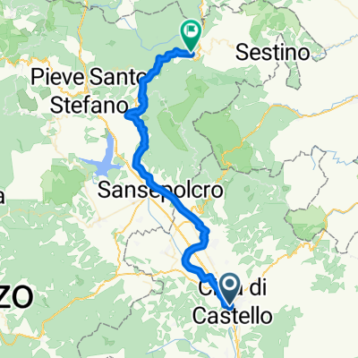
Overview
About this route
Route corresponding to the Road Book with indicated Rando Points
- -:--
- Duration
- 208.5 km
- Distance
- 1,897 m
- Ascent
- 1,912 m
- Descent
- ---
- Avg. speed
- ---
- Max. altitude

Route quality
Waytypes & surfaces along the route
Waytypes
Road
93.8 km
(45 %)
Quiet road
39.6 km
(19 %)
Surfaces
Paved
108.4 km
(52 %)
Asphalt
108.4 km
(52 %)
Undefined
100.1 km
(48 %)
Route highlights
Points of interest along the route
\"")
Point of interest after 17.7 km
Rando Point - Montone Hotel Fortebraccio Via dei Magistrati, 11 - Montone 0759306400
\"")
Point of interest after 61.1 km
RANDO POINT - Bar Jolly, via della Repubblica, 4. Tel. 0759273412
\"")
Point of interest after 113.6 km
Rando Point Hotel Green - Bar Osteria Cavatappi Via Campiglione 110
\"")
Point of interest after 133.7 km
Rando Point Bar Loris Via Brunamonti Brunacci 52 0755724294
\"")
Point of interest after 166.9 km
Rando Point UMBERTIDE Bar Stazione Piazza Gramsci 24 - Umbertide 0759413265
\"")
Point of interest after 194.7 km
RANDO POINT - Monte Santa maria Tiberina Il Poggio Loc. San Pietro 0758571034
Continue with Bikemap
Use, edit, or download this cycling route
You would like to ride Rando Umbria Nord - Randonnée di Città di Castello 200 km (ufficiale) or customize it for your own trip? Here is what you can do with this Bikemap route:
Free features
- Save this route as favorite or in collections
- Copy & plan your own version of this route
- Split it into stages to create a multi-day tour
- Sync your route with Garmin or Wahoo
Premium features
Free trial for 3 days, or one-time payment. More about Bikemap Premium.
- Navigate this route on iOS & Android
- Export a GPX / KML file of this route
- Create your custom printout (try it for free)
- Download this route for offline navigation
Discover more Premium features.
Get Bikemap PremiumFrom our community
Other popular routes starting in Città di Castello
 Rando Umbria Nord - Randonnée di Città di Castello 200 km (ufficiale)
- Distance
- 208.5 km
- Ascent
- 1,897 m
- Descent
- 1,912 m
- Location
- Città di Castello, Umbria, Italy
 RANDO UMBRIA NORD 120 KM - UFFICIALE
- Distance
- 117 km
- Ascent
- 865 m
- Descent
- 880 m
- Location
- Città di Castello, Umbria, Italy
 Tour Bocca Trabaria
- Distance
- 105.5 km
- Ascent
- 1,382 m
- Descent
- 1,384 m
- Location
- Città di Castello, Umbria, Italy
 2018 Assisi 7. dan (Citta di Castello - Assisi)
- Distance
- 65.7 km
- Ascent
- 338 m
- Descent
- 337 m
- Location
- Città di Castello, Umbria, Italy
 Italy Day 9, 48/730, Citta di Castello - Badia Tedalda
- Distance
- 48.2 km
- Ascent
- 772 m
- Descent
- 353 m
- Location
- Città di Castello, Umbria, Italy
 Citta di Castello - Bevagna
- Distance
- 198.1 km
- Ascent
- 2,180 m
- Descent
- 2,268 m
- Location
- Città di Castello, Umbria, Italy
 Giro dell'Umbria - Città di Castello/Montefalco
- Distance
- 107.1 km
- Ascent
- 517 m
- Descent
- 366 m
- Location
- Città di Castello, Umbria, Italy
 Città di Castello - Roma
- Distance
- 284.1 km
- Ascent
- 759 m
- Descent
- 1,017 m
- Location
- Città di Castello, Umbria, Italy
Open it in the app