

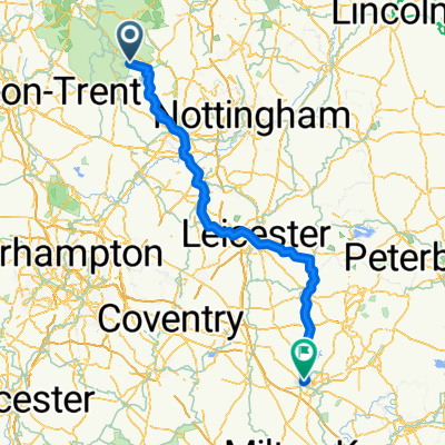
Matlock Top ten
A cycling route starting in Wirksworth, England, United Kingdom.
Overview
About this route
2016
- -:--
- Duration
- 61.4 km
- Distance
- 1,410 m
- Ascent
- 1,410 m
- Descent
- ---
- Avg. speed
- ---
- Max. altitude

Continue with Bikemap
Use, edit, or download this cycling route
You would like to ride Matlock Top ten or customize it for your own trip? Here is what you can do with this Bikemap route:
Free features
- Save this route as favorite or in collections
- Copy & plan your own version of this route
- Sync your route with Garmin or Wahoo
Premium features
Free trial for 3 days, or one-time payment. More about Bikemap Premium.
- Navigate this route on iOS & Android
- Export a GPX / KML file of this route
- Create your custom printout (try it for free)
- Download this route for offline navigation
Discover more Premium features.
Get Bikemap PremiumFrom our community
Other popular routes starting in Wirksworth
 Carsington loop
- Distance
- 45.7 km
- Ascent
- 313 m
- Descent
- 311 m
- Location
- Wirksworth, England, United Kingdom
 High Peak Trail, Wirksworth to Buxton
- Distance
- 15.6 km
- Ascent
- 46 m
- Descent
- 68 m
- Location
- Wirksworth, England, United Kingdom
 Wirksworth - Northampton
- Distance
- 151.5 km
- Ascent
- 1,152 m
- Descent
- 1,395 m
- Location
- Wirksworth, England, United Kingdom
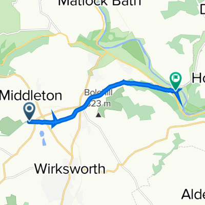 High Peak Trail, Middleton, Matlock to High Peak Trail, Whatstandwell, Matlock
- Distance
- 4.6 km
- Ascent
- 50 m
- Descent
- 264 m
- Location
- Wirksworth, England, United Kingdom
 Carsington Event #03 | 5K Run Course
- Distance
- 4.6 km
- Ascent
- 54 m
- Descent
- 54 m
- Location
- Wirksworth, England, United Kingdom
 Carsington Water
- Distance
- 12.4 km
- Ascent
- 124 m
- Descent
- 124 m
- Location
- Wirksworth, England, United Kingdom
 Peak District 1
- Distance
- 76.3 km
- Ascent
- 601 m
- Descent
- 600 m
- Location
- Wirksworth, England, United Kingdom
 Carsington Water Loop
- Distance
- 12.5 km
- Ascent
- 140 m
- Descent
- 137 m
- Location
- Wirksworth, England, United Kingdom
Open it in the app