

McDonough/Oconee National Forest
A cycling route starting in McDonough, Georgia, United States of America.
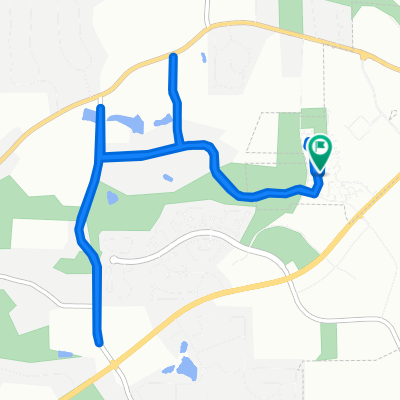
Overview
About this route
This ride will take you through some relaxing country roads full of tree and farm land. The route navigate through the South seperated section of the Oconee National Forest. Mcdonough to SR23 to SR83 to I20. Total ride is about 66 miles
- -:--
- Duration
- 107.3 km
- Distance
- 283 m
- Ascent
- 345 m
- Descent
- ---
- Avg. speed
- ---
- Max. altitude
Route quality
Waytypes & surfaces along the route
Waytypes
Busy road
74.9 km
(70 %)
Road
21.6 km
(20 %)
Surfaces
Paved
79 km
(74 %)
Unpaved
1.3 km
(1 %)
Asphalt
78.1 km
(73 %)
Unpaved (undefined)
1.3 km
(1 %)
Continue with Bikemap
Use, edit, or download this cycling route
You would like to ride McDonough/Oconee National Forest or customize it for your own trip? Here is what you can do with this Bikemap route:
Free features
- Save this route as favorite or in collections
- Copy & plan your own version of this route
- Split it into stages to create a multi-day tour
- Sync your route with Garmin or Wahoo
Premium features
Free trial for 3 days, or one-time payment. More about Bikemap Premium.
- Navigate this route on iOS & Android
- Export a GPX / KML file of this route
- Create your custom printout (try it for free)
- Download this route for offline navigation
Discover more Premium features.
Get Bikemap PremiumFrom our community
Other popular routes starting in McDonough
 mount Carmel loop plus trek
- Distance
- 29.9 km
- Ascent
- 158 m
- Descent
- 158 m
- Location
- McDonough, Georgia, United States of America
 Sunday morning with Nick💕
- Distance
- 24 km
- Ascent
- 120 m
- Descent
- 120 m
- Location
- McDonough, Georgia, United States of America
 Moderate Wednesday Ride In Mcdonough
- Distance
- 19 km
- Ascent
- 100 m
- Descent
- 97 m
- Location
- McDonough, Georgia, United States of America
 McDonough/Oconee National Forest
- Distance
- 107.3 km
- Ascent
- 283 m
- Descent
- 345 m
- Location
- McDonough, Georgia, United States of America
 to 155 ramp other side of 75
- Distance
- 4.1 km
- Ascent
- 155 m
- Descent
- 141 m
- Location
- McDonough, Georgia, United States of America
 nail loop
- Distance
- 11.7 km
- Ascent
- 136 m
- Descent
- 138 m
- Location
- McDonough, Georgia, United States of America
 15444444
- Distance
- 5.3 km
- Ascent
- 394 m
- Descent
- 373 m
- Location
- McDonough, Georgia, United States of America
 Paul trying to kill me
- Distance
- 31.6 km
- Ascent
- 156 m
- Descent
- 156 m
- Location
- McDonough, Georgia, United States of America
Open it in the app