

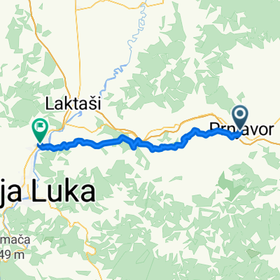
Ziua 29: Prnjavor - Brcko (BiH)
A cycling route starting in Prnjavor, Republika Srpska, Bosnia and Herzegovina.
Overview
About this route
- -:--
- Duration
- 137.8 km
- Distance
- 701 m
- Ascent
- 810 m
- Descent
- ---
- Avg. speed
- ---
- Max. altitude

Route quality
Waytypes & surfaces along the route
Waytypes
Quiet road
17.9 km
(13 %)
Road
9.6 km
(7 %)
Surfaces
Paved
107.5 km
(78 %)
Unpaved
2.8 km
(2 %)
Asphalt
107.5 km
(78 %)
Gravel
2.8 km
(2 %)
Undefined
27.6 km
(20 %)
Continue with Bikemap
Use, edit, or download this cycling route
You would like to ride Ziua 29: Prnjavor - Brcko (BiH) or customize it for your own trip? Here is what you can do with this Bikemap route:
Free features
- Save this route as favorite or in collections
- Copy & plan your own version of this route
- Split it into stages to create a multi-day tour
- Sync your route with Garmin or Wahoo
Premium features
Free trial for 3 days, or one-time payment. More about Bikemap Premium.
- Navigate this route on iOS & Android
- Export a GPX / KML file of this route
- Create your custom printout (try it for free)
- Download this route for offline navigation
Discover more Premium features.
Get Bikemap PremiumFrom our community
Other popular routes starting in Prnjavor
 7.6 dan 1
- Distance
- 183.7 km
- Ascent
- 168 m
- Descent
- 251 m
- Location
- Prnjavor, Republika Srpska, Bosnia and Herzegovina
 Osovica Bisnja
- Distance
- 98.9 km
- Ascent
- 518 m
- Descent
- 525 m
- Location
- Prnjavor, Republika Srpska, Bosnia and Herzegovina
 Ziua 29: Prnjavor - Brcko (BiH)
- Distance
- 137.8 km
- Ascent
- 701 m
- Descent
- 810 m
- Location
- Prnjavor, Republika Srpska, Bosnia and Herzegovina
 Prnjavor - Modriča
- Distance
- 71.4 km
- Ascent
- 228 m
- Descent
- 261 m
- Location
- Prnjavor, Republika Srpska, Bosnia and Herzegovina
 osovica
- Distance
- 86.2 km
- Ascent
- 446 m
- Descent
- 462 m
- Location
- Prnjavor, Republika Srpska, Bosnia and Herzegovina
 Svetog Save, Prnjavor nach Cara Dušana, Laktasi
- Distance
- 45.2 km
- Ascent
- 942 m
- Descent
- 967 m
- Location
- Prnjavor, Republika Srpska, Bosnia and Herzegovina
 prvi dan
- Distance
- 174.6 km
- Ascent
- 1,837 m
- Descent
- 1,058 m
- Location
- Prnjavor, Republika Srpska, Bosnia and Herzegovina
 Relaxed Sunday Ride In
- Distance
- 45.1 km
- Ascent
- 707 m
- Descent
- 825 m
- Location
- Prnjavor, Republika Srpska, Bosnia and Herzegovina
Open it in the app