

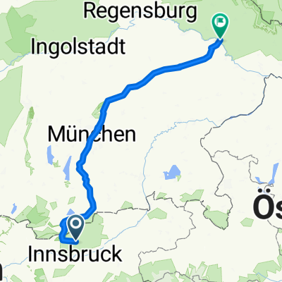
Isar von der Quelle bis zur Donau
A cycling route starting in Thaur, Tyrol, Austria.
Overview
About this route
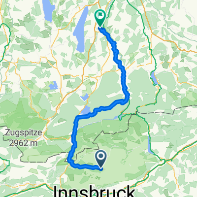
Etappe
-
0-18 Mittenwald - Isarquelle - Mittenwald 35 km 250 HM
-
18 - 77 Mittenwald - Bad Tölz 59 km 272 HM
-
72 - 134 Bad Tölz - München 62 km
-
134 - 187 München - Moosburg 53 km
-
187 - 245 Moosburg - Dingolfing 58 km
-
245 - 297 Dingolfing - Deggendorf 52 km
- -:--
- Duration
- 305.4 km
- Distance
- 116 m
- Ascent
- 938 m
- Descent
- ---
- Avg. speed
- ---
- Max. altitude

Continue with Bikemap
Use, edit, or download this cycling route
You would like to ride Isar von der Quelle bis zur Donau or customize it for your own trip? Here is what you can do with this Bikemap route:
Free features
- Save this route as favorite or in collections
- Copy & plan your own version of this route
- Split it into stages to create a multi-day tour
- Sync your route with Garmin or Wahoo
Premium features
Free trial for 3 days, or one-time payment. More about Bikemap Premium.
- Navigate this route on iOS & Android
- Export a GPX / KML file of this route
- Create your custom printout (try it for free)
- Download this route for offline navigation
Discover more Premium features.
Get Bikemap PremiumFrom our community
Other popular routes starting in Thaur
 CR Mittenwald, Isarquelle, Hallangerhaus, Überschalljoch
- Distance
- 116.8 km
- Ascent
- 1,200 m
- Descent
- 1,867 m
- Location
- Thaur, Tyrol, Austria
 Tour 1
- Distance
- 38.1 km
- Ascent
- 481 m
- Descent
- 480 m
- Location
- Thaur, Tyrol, Austria
 Isarradweg - GPX
- Distance
- 336.3 km
- Ascent
- 2,327 m
- Descent
- 3,175 m
- Location
- Thaur, Tyrol, Austria
 Transalp 2017 #2
- Distance
- 38.8 km
- Ascent
- 1,350 m
- Descent
- 1,516 m
- Location
- Thaur, Tyrol, Austria
 Isarradweg -Deggendorf - Isarradweg -Thundorf
- Distance
- 287.6 km
- Ascent
- 1,073 m
- Descent
- 1,920 m
- Location
- Thaur, Tyrol, Austria
 Isarradweg - vom Karwendel bis nach Deggendorf
- Distance
- 304.5 km
- Ascent
- 74 m
- Descent
- 922 m
- Location
- Thaur, Tyrol, Austria
 Vers. 1CR Mittenwald, Isarquelle, Hallangerhaus, Überschalljoch
- Distance
- 116.7 km
- Ascent
- 1,200 m
- Descent
- 1,867 m
- Location
- Thaur, Tyrol, Austria
 Isar Radweg Komplett
- Distance
- 311.5 km
- Ascent
- 217 m
- Descent
- 1,071 m
- Location
- Thaur, Tyrol, Austria
Open it in the app