

Ukraina 2016
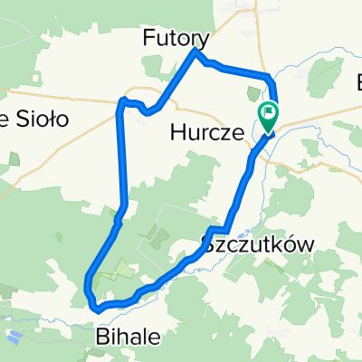
A cycling route starting in Lubaczów, Subcarpathian Voivodeship, Poland.
Overview
About this route
- -:--
- Duration
- 904 km
- Distance
- 1,287 m
- Ascent
- 1,285 m
- Descent
- ---
- Avg. speed
- ---
- Max. altitude
Route highlights
Points of interest along the route
Point of interest after 835.6 km
Continue with Bikemap
Use, edit, or download this cycling route
You would like to ride Ukraina 2016 or customize it for your own trip? Here is what you can do with this Bikemap route:
Free features
- Save this route as favorite or in collections
- Copy & plan your own version of this route
- Split it into stages to create a multi-day tour
- Sync your route with Garmin or Wahoo
Premium features
Free trial for 3 days, or one-time payment. More about Bikemap Premium.
- Navigate this route on iOS & Android
- Export a GPX / KML file of this route
- Create your custom printout (try it for free)
- Download this route for offline navigation
Discover more Premium features.
Get Bikemap PremiumFrom our community
Other popular routes starting in Lubaczów
 Recovered Route
- Distance
- 34.7 km
- Ascent
- 190 m
- Descent
- 195 m
- Location
- Lubaczów, Subcarpathian Voivodeship, Poland
 Roztocze asfaltem i przez las w 2 dni
- Distance
- 187.1 km
- Ascent
- 379 m
- Descent
- 379 m
- Location
- Lubaczów, Subcarpathian Voivodeship, Poland
 Lubaczów - Rzeszów szosa!
- Distance
- 100.2 km
- Ascent
- 274 m
- Descent
- 278 m
- Location
- Lubaczów, Subcarpathian Voivodeship, Poland
 Szlakiem mych Przodków Cisowskich (1920-1835)
- Distance
- 205 km
- Ascent
- 573 m
- Descent
- 572 m
- Location
- Lubaczów, Subcarpathian Voivodeship, Poland
 Lubaczów-Budomierz-Lubaczów (nowe przejście graniczne)
- Distance
- 30.6 km
- Ascent
- 113 m
- Descent
- 112 m
- Location
- Lubaczów, Subcarpathian Voivodeship, Poland
 krasnobrod
- Distance
- 125.6 km
- Ascent
- 378 m
- Descent
- 375 m
- Location
- Lubaczów, Subcarpathian Voivodeship, Poland
 Lubaczów - Tomaszów Lubelski (80 km)
- Distance
- 79.9 km
- Ascent
- 371 m
- Descent
- 312 m
- Location
- Lubaczów, Subcarpathian Voivodeship, Poland
 Akacjowa 24, Lubaczów do 71A, Wólka Horyniecka
- Distance
- 25.6 km
- Ascent
- 110 m
- Descent
- 75 m
- Location
- Lubaczów, Subcarpathian Voivodeship, Poland
Open it in the app