

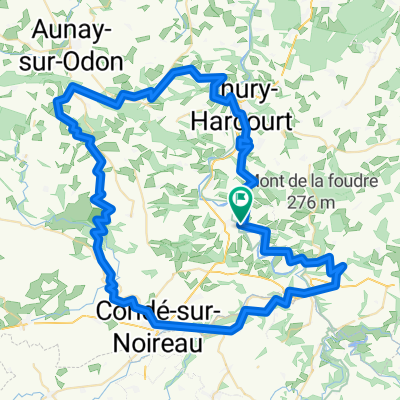
Clécy - Gacé (Tour du Pays d'Auge, Etape 4)
A cycling route starting in Clécy, Normandy, France.
Overview
About this route
- -:--
- Duration
- 72.9 km
- Distance
- 715 m
- Ascent
- 484 m
- Descent
- ---
- Avg. speed
- ---
- Max. altitude
Route quality
Waytypes & surfaces along the route
Waytypes
Road
38.6 km
(53 %)
Quiet road
10.9 km
(15 %)
Surfaces
Paved
7.3 km
(10 %)
Unpaved
2.2 km
(3 %)
Asphalt
7.3 km
(10 %)
Ground
1.5 km
(2 %)
Continue with Bikemap
Use, edit, or download this cycling route
You would like to ride Clécy - Gacé (Tour du Pays d'Auge, Etape 4) or customize it for your own trip? Here is what you can do with this Bikemap route:
Free features
- Save this route as favorite or in collections
- Copy & plan your own version of this route
- Sync your route with Garmin or Wahoo
Premium features
Free trial for 3 days, or one-time payment. More about Bikemap Premium.
- Navigate this route on iOS & Android
- Export a GPX / KML file of this route
- Create your custom printout (try it for free)
- Download this route for offline navigation
Discover more Premium features.
Get Bikemap PremiumFrom our community
Other popular routes starting in Clécy
 1ére étape Calva Camembert
- Distance
- 86.6 km
- Ascent
- 1,173 m
- Descent
- 1,172 m
- Location
- Clécy, Normandy, France
 Petite boucle en Suisse Normande
- Distance
- 22.4 km
- Ascent
- 460 m
- Descent
- 460 m
- Location
- Clécy, Normandy, France
 Clécy - Gacé (Tour du Pays d'Auge, Etape 4)
- Distance
- 72.9 km
- Ascent
- 715 m
- Descent
- 484 m
- Location
- Clécy, Normandy, France
 3éme étape Calva Camembert
- Distance
- 86.3 km
- Ascent
- 774 m
- Descent
- 774 m
- Location
- Clécy, Normandy, France
 Rouvrou -> Thury-Harcourt
- Distance
- 32.4 km
- Ascent
- 547 m
- Descent
- 580 m
- Location
- Clécy, Normandy, France
 2éme étape Calva Camembert
- Distance
- 52.3 km
- Ascent
- 888 m
- Descent
- 888 m
- Location
- Clécy, Normandy, France
 Parcours 100km Week-end Suisse Normande
- Distance
- 97.6 km
- Ascent
- 829 m
- Descent
- 810 m
- Location
- Clécy, Normandy, France
 2016 Sept Day 3 99km 710m
- Distance
- 97.8 km
- Ascent
- 633 m
- Descent
- 645 m
- Location
- Clécy, Normandy, France
Open it in the app