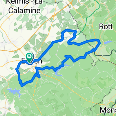
Vennbahn T7 Hogevenen vanaf Ternell 48 km
A cycling route starting in Eupen, Wallonia, Belgium.
Overview
About this route
- -:--
- Duration
- 48.4 km
- Distance
- 354 m
- Ascent
- 363 m
- Descent
- ---
- Avg. speed
- ---
- Max. altitude
Continue with Bikemap
Use, edit, or download this cycling route
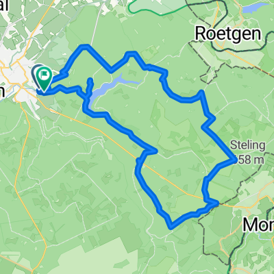
You would like to ride Vennbahn T7 Hogevenen vanaf Ternell 48 km or customize it for your own trip? Here is what you can do with this Bikemap route:
Free features
- Save this route as favorite or in collections
- Copy & plan your own version of this route
- Sync your route with Garmin or Wahoo
Premium features
Free trial for 3 days, or one-time payment. More about Bikemap Premium.
- Navigate this route on iOS & Android
- Export a GPX / KML file of this route
- Create your custom printout (try it for free)
- Download this route for offline navigation
Discover more Premium features.
Get Bikemap PremiumFrom our community
Other popular routes starting in Eupen
Veen en Meren 137km-2000hm- Distance
- 136.4 km
- Ascent
- 1,140 m
- Descent
- 1,137 m
- Location
- Eupen, Wallonia, Belgium
Aachener Straße, Eupen naar Oliemolenstraat, Heerlen- Distance
- 47.2 km
- Ascent
- 378 m
- Descent
- 539 m
- Location
- Eupen, Wallonia, Belgium
Eupen - Heimbach- Distance
- 49.7 km
- Ascent
- 848 m
- Descent
- 929 m
- Location
- Eupen, Wallonia, Belgium
Eupen - Hellenthal Etappe 1- Distance
- 47.8 km
- Ascent
- 691 m
- Descent
- 551 m
- Location
- Eupen, Wallonia, Belgium
Kettenis - Ternell - Reinartzhof- Distance
- 34.9 km
- Ascent
- 448 m
- Descent
- 374 m
- Location
- Eupen, Wallonia, Belgium
Eupen to Raeren VB- Distance
- 14.1 km
- Ascent
- 141 m
- Descent
- 107 m
- Location
- Eupen, Wallonia, Belgium
Vennbahn-Schleife 2 - Eupen- Distance
- 49.7 km
- Ascent
- 515 m
- Descent
- 514 m
- Location
- Eupen, Wallonia, Belgium
Von Eupen bis Tongern- Distance
- 66.2 km
- Ascent
- 439 m
- Descent
- 624 m
- Location
- Eupen, Wallonia, Belgium
Open it in the app


