Devil's Day Ride
A cycling route starting in Bismarck, North Dakota, United States of America.
Overview
About this route
- -:--
- Duration
- 12.2 km
- Distance
- 104 m
- Ascent
- 87 m
- Descent
- ---
- Avg. speed
- ---
- Avg. speed
Route quality
Waytypes & surfaces along the route
Waytypes
Road
5.3 km
(43 %)
Quiet road
3.2 km
(26 %)
Surfaces
Paved
0.6 km
(5 %)
Asphalt
0.5 km
(4 %)
Concrete
0.1 km
(<1 %)
Undefined
11.6 km
(95 %)
Route highlights
Points of interest along the route
Point of interest after 1.2 km
Point of interest after 2.2 km
Point of interest after 2.6 km
Point of interest after 3.6 km
Point of interest after 4.6 km
Point of interest after 5.9 km
Point of interest after 7.3 km
Point of interest after 9.6 km
Point of interest after 10.6 km
walrus
Continue with Bikemap
Use, edit, or download this cycling route
You would like to ride Devil's Day Ride or customize it for your own trip? Here is what you can do with this Bikemap route:
Free features
- Save this route as favorite or in collections
- Copy & plan your own version of this route
- Sync your route with Garmin or Wahoo
Premium features
Free trial for 3 days, or one-time payment. More about Bikemap Premium.
- Navigate this route on iOS & Android
- Export a GPX / KML file of this route
- Create your custom printout (try it for free)
- Download this route for offline navigation
Discover more Premium features.
Get Bikemap PremiumFrom our community
Other popular routes starting in Bismarck
- Devil's Day Ride
- Distance
- 12.2 km
- Ascent
- 104 m
- Descent
- 87 m
- Location
- Bismarck, North Dakota, United States of America
- Day 15 Lag 2
- Distance
- 115.1 km
- Ascent
- 313 m
- Descent
- 218 m
- Location
- Bismarck, North Dakota, United States of America
- New Salem Loop
- Distance
- 150.6 km
- Ascent
- 433 m
- Descent
- 430 m
- Location
- Bismarck, North Dakota, United States of America
- My start
- Distance
- 2,161.1 km
- Ascent
- 15,578 m
- Descent
- 15,998 m
- Location
- Bismarck, North Dakota, United States of America
- 229-> BISMARCK - MOTT
- Distance
- 167 km
- Ascent
- 567 m
- Descent
- 363 m
- Location
- Bismarck, North Dakota, United States of America
- Westwood Street 1300, Bismarck to 1st Street Southeast 801, Mandan
- Distance
- 9.2 km
- Ascent
- 22 m
- Descent
- 13 m
- Location
- Bismarck, North Dakota, United States of America
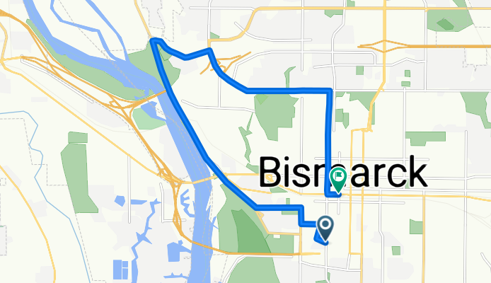
- 1265–1299 S 12th St, Bismarck to University Dr, Bismarck
- Distance
- 6.6 km
- Ascent
- 13 m
- Descent
- 16 m
- Location
- Bismarck, North Dakota, United States of America
- Riverside Park Road 299, Bismarck to Riverside Park Road 299, Bismarck
- Distance
- 4.5 km
- Ascent
- 7 m
- Descent
- 8 m
- Location
- Bismarck, North Dakota, United States of America
Open it in the app