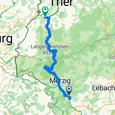
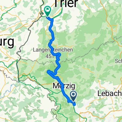
Niedtal/Gau-Tour_Gerlfangen-Siersburg-Hemmersdorf
- 14.5 km
- 245 m
- 244 m
- Beckingen, Saarland, Germany
A cycling route starting in Beckingen, Saarland, Germany.
Overview
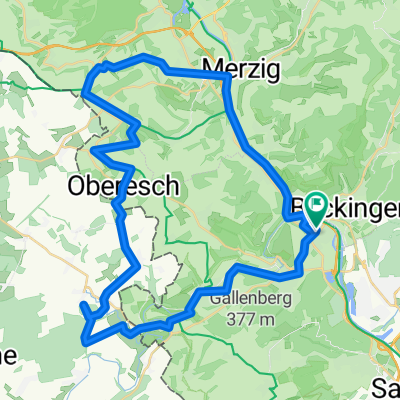
The route is 14 km long and only at the beginning about 2 km steeply ascending in parts. After that, it is rather flat and descending with only a small incline after crossing the floodplain of the Mühlenbach stream near Haustadt. The altitude difference is 386 m. Apart from the 256 steps on the first 2 kilometers, which do not need to be tackled continuously, it is easy to walk. Due to the steep ascent at the beginning, it is classified as moderately difficult. One should allow about 4 hours of walking time.
created this 9 years ago
Route highlights
<p>Der Sandsteinbau wurde 1858 im Stil einer kleinen gotischen Burg mit Bergfried erbaut.</p><p>Der Bahnhof markiert den Eingang zum unteren Saartal und in das Hausstadter Tal. Nach Zerstörungen im zweiten Weltkrieg wurde der "Alte Beckinger Bahnhof" umfangreich restauriert. In dem Gebäude sind unte
Sitzbank mit Aussicht
Natur schützen und Nutzen, so heißt das Motto des Gebietes.
Kirche
Tel.: 06835-7522
Sitzbank am Wanderweg
Sinnenbank Saartalblick
Rastplatz mit Sitzgruppe
Sinnenbank mit Aussicht
<p>Ein Zeugnis einer Kommende des Deutschherrenordens, die in Beckingen lange Zeit ihren Sitz hatte.</p><p>Es war Philipp Arnold von Ahr, Landkomtur der Deutschordensballei Lothringen und Komtur zu Beckingen, der die Marzelluskapelle 1634 im Stil der Spätrenaissance erbauen ließ. Das verraten die Gr
Continue with Bikemap
You would like to ride Traumschleife Beckinger Saarblicke or customize it for your own trip? Here is what you can do with this Bikemap route:
Free trial for 3 days, or one-time payment. More about Bikemap Premium.
Discover more Premium features.
Get Bikemap PremiumFrom our community
Open it in the app