

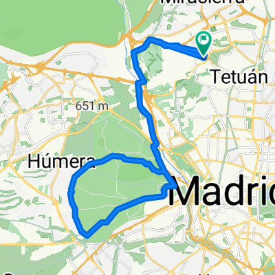
Madrid Río
A cycling route starting in Tetuán de las Victorias, Madrid, Spain.
Overview
About this route
De la Playa de Madrid a la Caja Mágica. Un paseo por la Senda del Rey y la ribera del Manzanares en Madrid.
Grupo de Senderismo de Coslada
- -:--
- Duration
- 16.4 km
- Distance
- 42 m
- Ascent
- 54 m
- Descent
- ---
- Avg. speed
- ---
- Avg. speed

Route quality
Waytypes & surfaces along the route
Waytypes
Cycleway
7.8 km
(48 %)
Pedestrian area
5.7 km
(35 %)
Surfaces
Paved
11.3 km
(69 %)
Unpaved
4 km
(24 %)
Asphalt
4.7 km
(29 %)
Concrete
3.6 km
(22 %)
Route highlights
Points of interest along the route
Point of interest after 0.9 km
Puente de San Fernando
Point of interest after 1.9 km
La Puerta de Hierro
Point of interest after 4.1 km
Palacio de la Moncloa
Point of interest after 4.9 km
Biblioteca Central UNED
Point of interest after 5.3 km
Primeros bares
Point of interest after 5.5 km
Puente de los Franceses
Point of interest after 6.7 km
San Antonio de la Florida (Frescos y tumba de Goya)
Point of interest after 7.4 km
Asilo de Lavanderas y Puerta de San Vicente
Point of interest after 7.5 km
Entrada Casa de Campo
Point of interest after 8 km
Puente de Segovia
Point of interest after 10.1 km
Puente de Toledo. Pradera de San Isidro
Point of interest after 12 km
Invernadero de La Arganzuela
Point of interest after 15.1 km
Atalaya: La Dama del Manzanares (Manolo Valdés)
Continue with Bikemap
Use, edit, or download this cycling route
You would like to ride Madrid Río or customize it for your own trip? Here is what you can do with this Bikemap route:
Free features
- Save this route as favorite or in collections
- Copy & plan your own version of this route
- Sync your route with Garmin or Wahoo
Premium features
Free trial for 3 days, or one-time payment. More about Bikemap Premium.
- Navigate this route on iOS & Android
- Export a GPX / KML file of this route
- Create your custom printout (try it for free)
- Download this route for offline navigation
Discover more Premium features.
Get Bikemap PremiumFrom our community
Other popular routes starting in Tetuán de las Victorias
 Brevet Randonneur 400K CC Chamartín 2017
- Distance
- 419.9 km
- Ascent
- 2,502 m
- Descent
- 3,202 m
- Location
- Tetuán de las Victorias, Madrid, Spain
 Ruta a la entrada de El Pardo
- Distance
- 16 km
- Ascent
- 160 m
- Descent
- 158 m
- Location
- Tetuán de las Victorias, Madrid, Spain
 Dehesa de la Villa-Pozuelo Estación
- Distance
- 9.2 km
- Ascent
- 90 m
- Descent
- 91 m
- Location
- Tetuán de las Victorias, Madrid, Spain
 usera
usera- Distance
- 16.2 km
- Ascent
- 40 m
- Descent
- 155 m
- Location
- Tetuán de las Victorias, Madrid, Spain
 Anillo ciclista desde Tetuán
- Distance
- 74.4 km
- Ascent
- 460 m
- Descent
- 460 m
- Location
- Tetuán de las Victorias, Madrid, Spain
 Brevet Randonneur 300K CC Chamartín 2017
- Distance
- 305.8 km
- Ascent
- 2,184 m
- Descent
- 2,181 m
- Location
- Tetuán de las Victorias, Madrid, Spain
 Casa Campo1
- Distance
- 11 km
- Ascent
- 24 m
- Descent
- 103 m
- Location
- Tetuán de las Victorias, Madrid, Spain
 Rodeo a la Casa de Campo
- Distance
- 31.7 km
- Ascent
- 191 m
- Descent
- 192 m
- Location
- Tetuán de las Victorias, Madrid, Spain
Open it in the app