

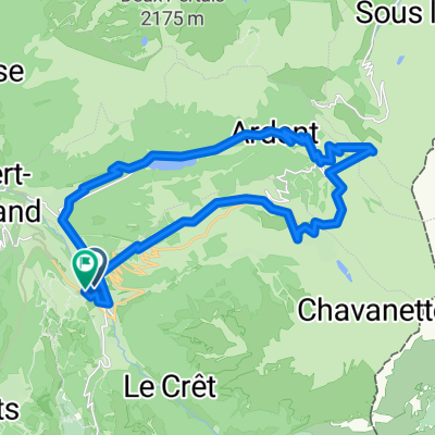
Alps Three Peaks Challenge Col de Joux Verte, Col de Jeu Plane, Col de l'Encrenaz
A cycling route starting in Morzine, Auvergne-Rhône-Alpes, France.
Overview
About this route
Some of the more serious Tour de France climbs including the infamous Col de Joux Plane from Morzine
- -:--
- Duration
- 76 km
- Distance
- 2,340 m
- Ascent
- 2,347 m
- Descent
- ---
- Avg. speed
- ---
- Max. altitude

Route quality
Waytypes & surfaces along the route
Waytypes
Road
38.8 km
(51 %)
Quiet road
6.8 km
(9 %)
Surfaces
Paved
53.2 km
(70 %)
Unpaved
4.6 km
(6 %)
Asphalt
50.9 km
(67 %)
Gravel
3 km
(4 %)
Continue with Bikemap
Use, edit, or download this cycling route
You would like to ride Alps Three Peaks Challenge Col de Joux Verte, Col de Jeu Plane, Col de l'Encrenaz or customize it for your own trip? Here is what you can do with this Bikemap route:
Free features
- Save this route as favorite or in collections
- Copy & plan your own version of this route
- Sync your route with Garmin or Wahoo
Premium features
Free trial for 3 days, or one-time payment. More about Bikemap Premium.
- Navigate this route on iOS & Android
- Export a GPX / KML file of this route
- Create your custom printout (try it for free)
- Download this route for offline navigation
Discover more Premium features.
Get Bikemap PremiumFrom our community
Other popular routes starting in Morzine
 Avoriaz and above to Col du Fornet
- Distance
- 47.9 km
- Ascent
- 1,535 m
- Descent
- 1,530 m
- Location
- Morzine, Auvergne-Rhône-Alpes, France
 Morzine-Fantasticable-Les Lindaretes-Lac de Montriond-Morzine
- Distance
- 26.4 km
- Ascent
- 1,554 m
- Descent
- 1,553 m
- Location
- Morzine, Auvergne-Rhône-Alpes, France
 Tour of Le Roc d'Enfer Alps Challenge Route
- Distance
- 109.8 km
- Ascent
- 1,883 m
- Descent
- 1,883 m
- Location
- Morzine, Auvergne-Rhône-Alpes, France
 Alps Three Peaks Challenge Col de Joux Verte, Col de Jeu Plane, Col de l'Encrenaz
- Distance
- 76 km
- Ascent
- 2,340 m
- Descent
- 2,347 m
- Location
- Morzine, Auvergne-Rhône-Alpes, France
 Morzine - Col de la Joux Verte
- Distance
- 30.3 km
- Ascent
- 861 m
- Descent
- 861 m
- Location
- Morzine, Auvergne-Rhône-Alpes, France
 Joux Verte-Joux Plane-Ramaz-Encrenaz
- Distance
- 106.8 km
- Ascent
- 3,605 m
- Descent
- 3,602 m
- Location
- Morzine, Auvergne-Rhône-Alpes, France
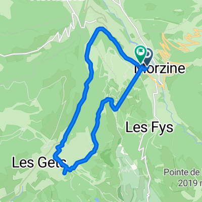 Morzine-Lac des Ecoles-Les Gets-Morzine
- Distance
- 12.3 km
- Ascent
- 608 m
- Descent
- 606 m
- Location
- Morzine, Auvergne-Rhône-Alpes, France
 Morzine - Col de la Ramaz - Col de la Colombière
- Distance
- 133.7 km
- Ascent
- 2,660 m
- Descent
- 2,654 m
- Location
- Morzine, Auvergne-Rhône-Alpes, France
Open it in the app