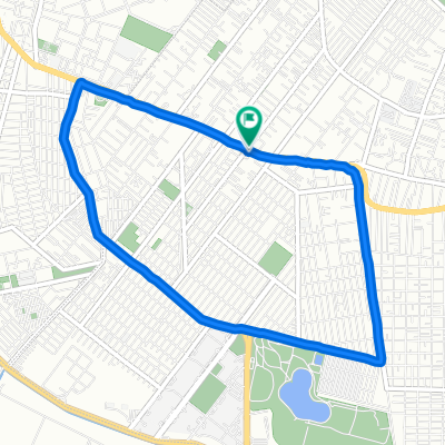
TLAHUAC CHALMA
A cycling route starting in Tlahuac, Mexico City, Mexico.
Overview
About this route
- -:--
- Duration
- 205.2 km
- Distance
- 3,064 m
- Ascent
- 3,067 m
- Descent
- ---
- Avg. speed
- ---
- Avg. speed
Route quality
Waytypes & surfaces along the route
Waytypes
Busy road
144.7 km
(71 %)
Quiet road
29.4 km
(14 %)
Surfaces
Paved
122.6 km
(60 %)
Unpaved
19.2 km
(9 %)
Asphalt
119.4 km
(58 %)
Unpaved (undefined)
18.8 km
(9 %)
Continue with Bikemap
Use, edit, or download this cycling route
You would like to ride TLAHUAC CHALMA or customize it for your own trip? Here is what you can do with this Bikemap route:
Free features
- Save this route as favorite or in collections
- Copy & plan your own version of this route
- Split it into stages to create a multi-day tour
- Sync your route with Garmin or Wahoo
Premium features
Free trial for 3 days, or one-time payment. More about Bikemap Premium.
- Navigate this route on iOS & Android
- Export a GPX / KML file of this route
- Create your custom printout (try it for free)
- Download this route for offline navigation
Discover more Premium features.
Get Bikemap PremiumFrom our community
Other popular routes starting in Tlahuac
- Paseo tranquilo
- Distance
- 40.2 km
- Ascent
- 634 m
- Descent
- 133 m
- Location
- Tlahuac, Mexico City, Mexico
- riooo friooo
- Distance
- 108.1 km
- Ascent
- 1,196 m
- Descent
- 1,201 m
- Location
- Tlahuac, Mexico City, Mexico
- TLAHUAC CHALMA
- Distance
- 205.2 km
- Ascent
- 3,064 m
- Descent
- 3,067 m
- Location
- Tlahuac, Mexico City, Mexico
- De Del Bosque 4, Ciudad de México a Mirador El derrumbe, Ciudad de México
- Distance
- 9.7 km
- Ascent
- 340 m
- Descent
- 839 m
- Location
- Tlahuac, Mexico City, Mexico
- EL CONDOR
- Distance
- 188.7 km
- Ascent
- 2,542 m
- Descent
- 2,543 m
- Location
- Tlahuac, Mexico City, Mexico
- rio frio
- Distance
- 95.5 km
- Ascent
- 1,188 m
- Descent
- 1,185 m
- Location
- Tlahuac, Mexico City, Mexico
- los dinamos
- Distance
- 110.8 km
- Ascent
- 1,544 m
- Descent
- 1,545 m
- Location
- Tlahuac, Mexico City, Mexico
- De Alamos 5, San Juan a C. Del Rosario 51
- Distance
- 59.1 km
- Ascent
- 1,941 m
- Descent
- 524 m
- Location
- Tlahuac, Mexico City, Mexico
Open it in the app