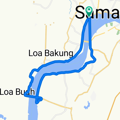
DENAH JALUR GOES
A cycling route starting in Samarinda, East Kalimantan, Indonesia.
Overview
About this route
KEMENTRIAN HUKUM DAN HAM
13 NOVEMBER 2016
- -:--
- Duration
- 10.2 km
- Distance
- 78 m
- Ascent
- 72 m
- Descent
- ---
- Avg. speed
- ---
- Avg. speed
Continue with Bikemap
Use, edit, or download this cycling route
You would like to ride DENAH JALUR GOES or customize it for your own trip? Here is what you can do with this Bikemap route:
Free features
- Save this route as favorite or in collections
- Copy & plan your own version of this route
- Sync your route with Garmin or Wahoo
Premium features
Free trial for 3 days, or one-time payment. More about Bikemap Premium.
- Navigate this route on iOS & Android
- Export a GPX / KML file of this route
- Create your custom printout (try it for free)
- Download this route for offline navigation
Discover more Premium features.
Get Bikemap PremiumFrom our community
Other popular routes starting in Samarinda
- DENAH JALUR GOES
- Distance
- 10.2 km
- Ascent
- 78 m
- Descent
- 72 m
- Location
- Samarinda, East Kalimantan, Indonesia
- DENAH JALUR GOES
- Distance
- 10.4 km
- Ascent
- 48 m
- Descent
- 45 m
- Location
- Samarinda, East Kalimantan, Indonesia
- Bukit RCTI
- Distance
- 10 km
- Ascent
- 398 m
- Descent
- 395 m
- Location
- Samarinda, East Kalimantan, Indonesia
- gowes part 2
- Distance
- 10.2 km
- Ascent
- 213 m
- Descent
- 237 m
- Location
- Samarinda, East Kalimantan, Indonesia
- Jalan Pipit 22, Kecamatan Sungai Pinang to G4PR+R3M, Kecamatan Samarinda Ulu
- Distance
- 3.7 km
- Ascent
- 9 m
- Descent
- 55 m
- Location
- Samarinda, East Kalimantan, Indonesia
- road to mahkota dua
- Distance
- 20 km
- Ascent
- 571 m
- Descent
- 570 m
- Location
- Samarinda, East Kalimantan, Indonesia
- GOES KEMENKUMHAM
- Distance
- 11.1 km
- Ascent
- 67 m
- Descent
- 63 m
- Location
- Samarinda, East Kalimantan, Indonesia
- Jumaat 1 Feb 2019
- Distance
- 32.1 km
- Ascent
- 506 m
- Descent
- 504 m
- Location
- Samarinda, East Kalimantan, Indonesia
Open it in the app