

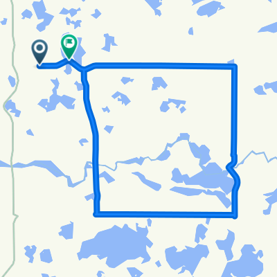
BikeMN Tour Map
A cycling route starting in Fergus Falls, Minnesota, United States.
Overview
About this route
- -:--
- Duration
- 18.8 km
- Distance
- 99 m
- Ascent
- 97 m
- Descent
- ---
- Avg. speed
- ---
- Max. altitude

Route quality
Waytypes & surfaces along the route
Waytypes
Quiet road
14.1 km
(75 %)
Road
3 km
(16 %)
Surfaces
Paved
2.4 km
(13 %)
Unpaved
0.2 km
(1 %)
Asphalt
2.4 km
(13 %)
Gravel
0.2 km
(1 %)
Undefined
16.2 km
(86 %)
Route highlights
Points of interest along the route
Point of interest after 1.1 km
Lake Region Takes Root
Point of interest after 2.9 km
Westside Drive Trail Connection
Point of interest after 5.2 km
Hillcrest
Point of interest after 6.4 km
Courthouse and Police Station
Point of interest after 6.8 km
Library / Bike Repair Station
Point of interest after 8 km
Otto the Otter
Point of interest after 9.5 km
City Hall
Point of interest after 10.1 km
Lincoln Avenue
Point of interest after 11.3 km
Lake Alice
Point of interest after 12.5 km
Kirkbride
Point of interest after 13.7 km
Noyes Park
Point of interest after 16.1 km
Museum
Continue with Bikemap
Use, edit, or download this cycling route
You would like to ride BikeMN Tour Map or customize it for your own trip? Here is what you can do with this Bikemap route:
Free features
- Save this route as favorite or in collections
- Copy & plan your own version of this route
- Sync your route with Garmin or Wahoo
Premium features
Free trial for 3 days, or one-time payment. More about Bikemap Premium.
- Navigate this route on iOS & Android
- Export a GPX / KML file of this route
- Create your custom printout (try it for free)
- Download this route for offline navigation
Discover more Premium features.
Get Bikemap PremiumFrom our community
Other popular routes starting in Fergus Falls
 2016 Mayor's Ride
- Distance
- 3.3 km
- Ascent
- 23 m
- Descent
- 23 m
- Location
- Fergus Falls, Minnesota, United States
 Day 20 Lag 2
- Distance
- 173.3 km
- Ascent
- 215 m
- Descent
- 261 m
- Location
- Fergus Falls, Minnesota, United States
 Route in Erhard
- Distance
- 29 km
- Ascent
- 174 m
- Descent
- 163 m
- Location
- Fergus Falls, Minnesota, United States
 BikeMN Tour Map
- Distance
- 18.8 km
- Ascent
- 99 m
- Descent
- 97 m
- Location
- Fergus Falls, Minnesota, United States
 Bike Your Park Ride 2018
- Distance
- 26.3 km
- Ascent
- 116 m
- Descent
- 115 m
- Location
- Fergus Falls, Minnesota, United States
 1210 19th St, Fergus Falls to 1210 19th St, Fergus Falls
- Distance
- 26.1 km
- Ascent
- 79 m
- Descent
- 81 m
- Location
- Fergus Falls, Minnesota, United States
 Fergus Falls Signature Event Ride
- Distance
- 27.7 km
- Ascent
- 128 m
- Descent
- 127 m
- Location
- Fergus Falls, Minnesota, United States
 Summerfest Ride - Longer Route
- Distance
- 24.7 km
- Ascent
- 100 m
- Descent
- 100 m
- Location
- Fergus Falls, Minnesota, United States
Open it in the app