
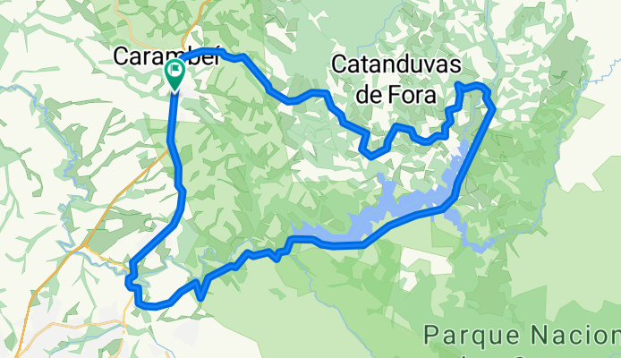
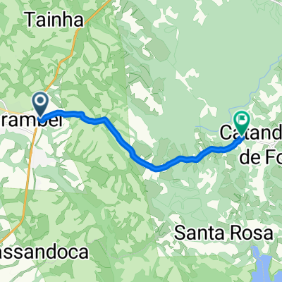
Alagados - Carambeí
A cycling route starting in Carambeí, Paraná, Brazil.
Overview
About this route
- -:--
- Duration
- 54.5 km
- Distance
- 557 m
- Ascent
- 557 m
- Descent
- ---
- Avg. speed
- ---
- Max. altitude

Continue with Bikemap
Use, edit, or download this cycling route
You would like to ride Alagados - Carambeí or customize it for your own trip? Here is what you can do with this Bikemap route:
Free features
- Save this route as favorite or in collections
- Copy & plan your own version of this route
- Sync your route with Garmin or Wahoo
Premium features
Free trial for 3 days, or one-time payment. More about Bikemap Premium.
- Navigate this route on iOS & Android
- Export a GPX / KML file of this route
- Create your custom printout (try it for free)
- Download this route for offline navigation
Discover more Premium features.
Get Bikemap PremiumFrom our community
Other popular routes starting in Carambeí
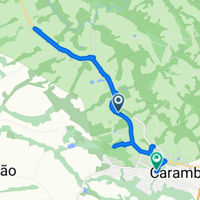 De Avenida dos Pioneiros 3444 a Avenida das Flôres 1302
- Distance
- 14.4 km
- Ascent
- 131 m
- Descent
- 127 m
- Location
- Carambeí, Paraná, Brazil
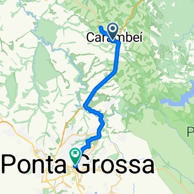 Carambeí - Ponta Grossa
- Distance
- 27.9 km
- Ascent
- 449 m
- Descent
- 530 m
- Location
- Carambeí, Paraná, Brazil
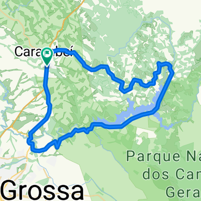
 De Unnamed Road a Unnamed Road
- Distance
- 37.9 km
- Ascent
- 406 m
- Descent
- 331 m
- Location
- Carambeí, Paraná, Brazil
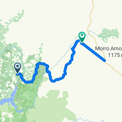
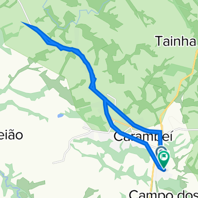
 Carambeí -Catanduvas
- Distance
- 9.5 km
- Ascent
- 117 m
- Descent
- 139 m
- Location
- Carambeí, Paraná, Brazil
 De Rua Rio São Francisco, 2–86, Carambeí a Rua Rio Tocantins, 1–135, Carambeí
- Distance
- 17.2 km
- Ascent
- 2,634 m
- Descent
- 2,640 m
- Location
- Carambeí, Paraná, Brazil
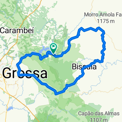 PG-Abapa-PG
- Distance
- 105.2 km
- Ascent
- 848 m
- Descent
- 848 m
- Location
- Carambeí, Paraná, Brazil
 Alagados - Carambeí
- Distance
- 54.5 km
- Ascent
- 557 m
- Descent
- 557 m
- Location
- Carambeí, Paraná, Brazil
Open it in the app