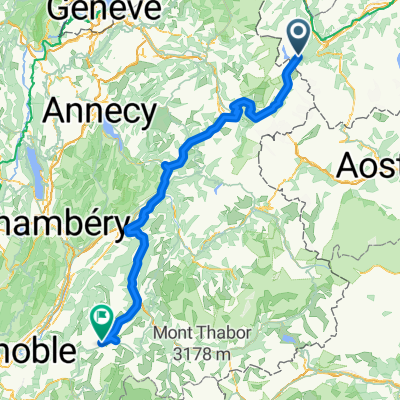
2017 ALPS Etapa 7 - Le Grand St Bernanrd
A cycling route starting in Martigny-Combe, Valais, Switzerland.
Overview
About this route
- -:--
- Duration
- 108.8 km
- Distance
- 2,888 m
- Ascent
- 2,896 m
- Descent
- ---
- Avg. speed
- ---
- Avg. speed
Route quality
Waytypes & surfaces along the route
Waytypes
Busy road
105.9 km
(97 %)
Access road
2.1 km
(2 %)
Surfaces
Paved
89.5 km
(82 %)
Unpaved
0.2 km
(<1 %)
Asphalt
89.5 km
(82 %)
Unpaved (undefined)
0.2 km
(<1 %)
Undefined
19.1 km
(18 %)
Route highlights
Points of interest along the route
Point of interest after 0.4 km
Col de la Forclaz 16km 6,5% 9% 1050m http://www.cols-cyclisme.com/massif-du-mont-blanc/suisse/col-de-la-forclaz-depuis-martigny-c626.htm
Point of interest after 54.3 km
Col du Grand St Bernard 30km 5,7% 9,7%max 1720 m http://www.cols-cyclisme.com/alpes-valaisannes/suisse/col-du-grand-saint-bernard-depuis-sembrancher-c146.htm
Continue with Bikemap
Use, edit, or download this cycling route
You would like to ride 2017 ALPS Etapa 7 - Le Grand St Bernanrd or customize it for your own trip? Here is what you can do with this Bikemap route:
Free features
- Save this route as favorite or in collections
- Copy & plan your own version of this route
- Split it into stages to create a multi-day tour
- Sync your route with Garmin or Wahoo
Premium features
Free trial for 3 days, or one-time payment. More about Bikemap Premium.
- Navigate this route on iOS & Android
- Export a GPX / KML file of this route
- Create your custom printout (try it for free)
- Download this route for offline navigation
Discover more Premium features.
Get Bikemap PremiumFrom our community
Other popular routes starting in Martigny-Combe
- MontBlancTour5Tag
- Distance
- 14 km
- Ascent
- 1,107 m
- Descent
- 935 m
- Location
- Martigny-Combe, Valais, Switzerland
- 2017 ALPS Etapa 7 - Le Grand St Bernanrd
- Distance
- 108.8 km
- Ascent
- 2,888 m
- Descent
- 2,896 m
- Location
- Martigny-Combe, Valais, Switzerland
- Tour de France 2009, Etappe 16 - 159,0 km
- Distance
- 158.8 km
- Ascent
- 4,155 m
- Descent
- 3,153 m
- Location
- Martigny-Combe, Valais, Switzerland
- WA_4_Forclaz_Martigny_VEVEY
- Distance
- 71.3 km
- Ascent
- 103 m
- Descent
- 1,225 m
- Location
- Martigny-Combe, Valais, Switzerland
- Trevor Base Route
- Distance
- 93.3 km
- Ascent
- 715 m
- Descent
- 715 m
- Location
- Martigny-Combe, Valais, Switzerland
- Champex and Val Ferret
- Distance
- 62.9 km
- Ascent
- 1,722 m
- Descent
- 1,722 m
- Location
- Martigny-Combe, Valais, Switzerland
- Trevor - Champex and Planche
- Distance
- 51.3 km
- Ascent
- 1,740 m
- Descent
- 1,740 m
- Location
- Martigny-Combe, Valais, Switzerland
- Startup Route des Grandes Alpes
- Distance
- 40 km
- Ascent
- 1,360 m
- Descent
- 834 m
- Location
- Martigny-Combe, Valais, Switzerland
Open it in the app