

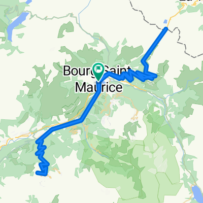
2017 ALPS ETAPA 1 - Iseran-savonne
A cycling route starting in Bourg-Saint-Maurice, Auvergne-Rhône-Alpes, France.
Overview
About this route
Alps 2017 stage 1 Col de l'Iseran
- -:--
- Duration
- 110.9 km
- Distance
- 2,717 m
- Ascent
- 2,720 m
- Descent
- ---
- Avg. speed
- ---
- Max. altitude

Route highlights
Points of interest along the route
Point of interest after 47.7 km
Col de l'Iseran 48km 4% max 7% 1955 http://www.cols-cyclisme.com/vanoise/france/col-de-l-iseran-depuis-bourg-saint-maurice-c105.htm
Point of interest after 90.1 km
Col de la Savonne 7km 10,5% max 20% 729m http://www.cols-cyclisme.com/massif-du-mont-blanc/france/la-savonne-depuis-sainte-foy-tarentaise-c2382.htm
Continue with Bikemap
Use, edit, or download this cycling route
You would like to ride 2017 ALPS ETAPA 1 - Iseran-savonne or customize it for your own trip? Here is what you can do with this Bikemap route:
Free features
- Save this route as favorite or in collections
- Copy & plan your own version of this route
- Split it into stages to create a multi-day tour
- Sync your route with Garmin or Wahoo
Premium features
Free trial for 3 days, or one-time payment. More about Bikemap Premium.
- Navigate this route on iOS & Android
- Export a GPX / KML file of this route
- Create your custom printout (try it for free)
- Download this route for offline navigation
Discover more Premium features.
Get Bikemap PremiumFrom our community
Other popular routes starting in Bourg-Saint-Maurice
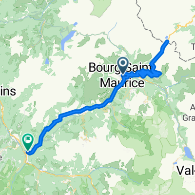
 Day 8 - Bourg Saint Maurice, Iseran - 94 Km / 2300 m
- Distance
- 94.2 km
- Ascent
- 2,989 m
- Descent
- 2,990 m
- Location
- Bourg-Saint-Maurice, Auvergne-Rhône-Alpes, France
 2017 ALPS Etapa 2 - La plagne
- Distance
- 120 km
- Ascent
- 2,737 m
- Descent
- 2,737 m
- Location
- Bourg-Saint-Maurice, Auvergne-Rhône-Alpes, France
 2017 ALPS Col de l'Iseran a
- Distance
- 147.7 km
- Ascent
- 3,138 m
- Descent
- 3,138 m
- Location
- Bourg-Saint-Maurice, Auvergne-Rhône-Alpes, France
 Petit St. Bernard, Aosta
- Distance
- 114.6 km
- Ascent
- 3,024 m
- Descent
- 3,026 m
- Location
- Bourg-Saint-Maurice, Auvergne-Rhône-Alpes, France
 COL DU PETIT SAINT-BERNARD (por Bourg Saint-Maurice)
- Distance
- 94.5 km
- Ascent
- 1,987 m
- Descent
- 2,319 m
- Location
- Bourg-Saint-Maurice, Auvergne-Rhône-Alpes, France
 Cormet de Roselend
- Distance
- 84.3 km
- Ascent
- 3,144 m
- Descent
- 3,145 m
- Location
- Bourg-Saint-Maurice, Auvergne-Rhône-Alpes, France
 2017 ALPS ETAPA 1 - Iseran-savonne
- Distance
- 110.9 km
- Ascent
- 2,717 m
- Descent
- 2,720 m
- Location
- Bourg-Saint-Maurice, Auvergne-Rhône-Alpes, France
 Col du Petit Saint-Bernard
- Distance
- 105.6 km
- Ascent
- 2,537 m
- Descent
- 2,537 m
- Location
- Bourg-Saint-Maurice, Auvergne-Rhône-Alpes, France
Open it in the app