

Alpsee - Gunzesriedertal - Hochgrat - Steibis
A cycling route starting in Missen-Wilhams, Bavaria, Germany.
Overview
About this route
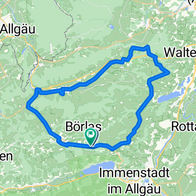
A very beautiful route passing by the stunning Alpsee heading towards Immenstadt and Blaichach. Shortly after Blaichach, you turn right into the Gunzesried Valley up to the Hochgrat. From here, there is a wonderful view towards Austria and Switzerland. Up to here, everything is easily rideable. Descending from the Hochgrat into the valley, the path is made of coarse gravel and is not fully rideable. This is the only downside of this wonderful route.
The route then continues towards Steibis and Oberstaufen, returning towards Alpsee.
- -:--
- Duration
- 54.3 km
- Distance
- 1,188 m
- Ascent
- 1,185 m
- Descent
- ---
- Avg. speed
- ---
- Max. altitude
Continue with Bikemap
Use, edit, or download this cycling route
You would like to ride Alpsee - Gunzesriedertal - Hochgrat - Steibis or customize it for your own trip? Here is what you can do with this Bikemap route:
Free features
- Save this route as favorite or in collections
- Copy & plan your own version of this route
- Sync your route with Garmin or Wahoo
Premium features
Free trial for 3 days, or one-time payment. More about Bikemap Premium.
- Navigate this route on iOS & Android
- Export a GPX / KML file of this route
- Create your custom printout (try it for free)
- Download this route for offline navigation
Discover more Premium features.
Get Bikemap PremiumFrom our community
Other popular routes starting in Missen-Wilhams
 4 Oberstaufen - Osterreinen
- Distance
- 56.9 km
- Ascent
- 706 m
- Descent
- 640 m
- Location
- Missen-Wilhams, Bavaria, Germany
 Ratholz-Starkatsgund-Alpe-Bühl-Ratholz
- Distance
- 17.8 km
- Ascent
- 645 m
- Descent
- 647 m
- Location
- Missen-Wilhams, Bavaria, Germany
 Alpsee - Gunzesriedertal - Hochgrat - Steibis
- Distance
- 54.3 km
- Ascent
- 1,188 m
- Descent
- 1,185 m
- Location
- Missen-Wilhams, Bavaria, Germany
 E-Bike Missen Hirnbeinalpe Alpsee
- Distance
- 39.2 km
- Ascent
- 662 m
- Descent
- 654 m
- Location
- Missen-Wilhams, Bavaria, Germany
 Ackern am Alpsee
- Distance
- 33.3 km
- Ascent
- 878 m
- Descent
- 881 m
- Location
- Missen-Wilhams, Bavaria, Germany
 Wiederhofen-Ravensburg-retour
- Distance
- 137.7 km
- Ascent
- 1,030 m
- Descent
- 1,029 m
- Location
- Missen-Wilhams, Bavaria, Germany
 s28.Pfarr_Siedel_19_570_440
- Distance
- 18.5 km
- Ascent
- 569 m
- Descent
- 441 m
- Location
- Missen-Wilhams, Bavaria, Germany
 Oberstixner, Waldhäusle, Schmucker, Oberstixner
- Distance
- 42.8 km
- Ascent
- 780 m
- Descent
- 782 m
- Location
- Missen-Wilhams, Bavaria, Germany
Open it in the app