

grok e-dok
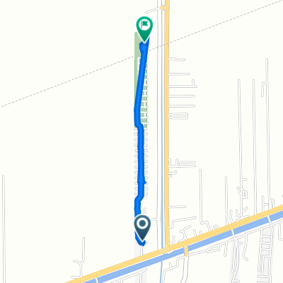
A cycling route starting in Thanyaburi, Pathum Thani, Thailand.
Overview
About this route
<span style="color: #909191; font-family: 'lucida grande', arial, verdana, sans-serif; font-size: 12px;">rode up to grok e-dok again, went up khlong 7, the road is pretty bad. messed up my schedule (almost double the planned time). the road up into grok e-dok itself got messed up during the rainy season (stream side edges got washed out) & slowed me down to a crawl. got 2 flats in the dark 9km from home & called it quits (hopped a taxi).</span>
- -:--
- Duration
- 173.3 km
- Distance
- 200 m
- Ascent
- 200 m
- Descent
- ---
- Avg. speed
- ---
- Max. altitude
Continue with Bikemap
Use, edit, or download this cycling route
You would like to ride grok e-dok or customize it for your own trip? Here is what you can do with this Bikemap route:
Free features
- Save this route as favorite or in collections
- Copy & plan your own version of this route
- Split it into stages to create a multi-day tour
- Sync your route with Garmin or Wahoo
Premium features
Free trial for 3 days, or one-time payment. More about Bikemap Premium.
- Navigate this route on iOS & Android
- Export a GPX / KML file of this route
- Create your custom printout (try it for free)
- Download this route for offline navigation
Discover more Premium features.
Get Bikemap PremiumFrom our community
Other popular routes starting in Thanyaburi
 two day
- Distance
- 2.6 km
- Ascent
- 4 m
- Descent
- 4 m
- Location
- Thanyaburi, Pathum Thani, Thailand
 ตำบล บึงบอน to ประเทศไทย
- Distance
- 61.8 km
- Ascent
- 381 m
- Descent
- 375 m
- Location
- Thanyaburi, Pathum Thani, Thailand
 คลอง9
คลอง9- Distance
- 33.4 km
- Ascent
- 5 m
- Descent
- 11 m
- Location
- Thanyaburi, Pathum Thani, Thailand
 ตำบล บึงสนั่น to 3R8F+F38, ตำบล บึงสนั่น
- Distance
- 1.7 km
- Ascent
- 53 m
- Descent
- 59 m
- Location
- Thanyaburi, Pathum Thani, Thailand
 ตำบล บึงบอน to บริษัทออฟฟิศพลัสจำกัด, ตำบล คลองหนึ่ง
- Distance
- 58.5 km
- Ascent
- 381 m
- Descent
- 392 m
- Location
- Thanyaburi, Pathum Thani, Thailand
 อำเภอธัญบุรี, ตำบล บึงสนั่น to 3R5F+9V5, ตำบล บึงสนั่น
- Distance
- 1.9 km
- Ascent
- 25 m
- Descent
- 25 m
- Location
- Thanyaburi, Pathum Thani, Thailand
 ซอยหมู่บ้านสัมมากร รังสิตคลอง 7, อ.ธัญบุรี to ซอยหมู่บ้านสัมมากร รังสิตคลอง 7, อ.ธัญบุรี
- Distance
- 17.5 km
- Ascent
- 8 m
- Descent
- 10 m
- Location
- Thanyaburi, Pathum Thani, Thailand
 J3 - Vendredi 17/01/2014 - Thanya Buri - Ayutthaya
- Distance
- 53.9 km
- Ascent
- 8 m
- Descent
- 6 m
- Location
- Thanyaburi, Pathum Thani, Thailand
Open it in the app