

khao ito
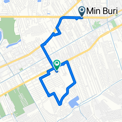
A cycling route starting in Min Buri, Bangkok, Thailand.
Overview
About this route
<span style="font-family: 'lucida grande', arial, verdana, sans-serif; color: #909191; font-size: small;"><span style="font-size: 12px;">deceptively steep, so steep that the GPS went into auto-pause mode so often it messed up the track up the mountain. had to ice up my knees after the ride.</span></span>
- -:--
- Duration
- 172.1 km
- Distance
- 170 m
- Ascent
- 174 m
- Descent
- ---
- Avg. speed
- ---
- Max. altitude
Continue with Bikemap
Use, edit, or download this cycling route
You would like to ride khao ito or customize it for your own trip? Here is what you can do with this Bikemap route:
Free features
- Save this route as favorite or in collections
- Copy & plan your own version of this route
- Split it into stages to create a multi-day tour
- Sync your route with Garmin or Wahoo
Premium features
Free trial for 3 days, or one-time payment. More about Bikemap Premium.
- Navigate this route on iOS & Android
- Export a GPX / KML file of this route
- Create your custom printout (try it for free)
- Download this route for offline navigation
Discover more Premium features.
Get Bikemap PremiumFrom our community
Other popular routes starting in Min Buri
 ซอย หมู่บ้านพฤกษาปูริวงจันทร์ รามอินทรา-มีนบุรี, กรุงเทพมหานคร to ซอย หมู่บ้านพฤกษาปูริวงจันทร์ รามอินทรา-มีนบุรี, กรุงเทพมหานคร
- Distance
- 12.4 km
- Ascent
- 19 m
- Descent
- 15 m
- Location
- Min Buri, Bangkok, Thailand
 30 Dec
- Distance
- 14.2 km
- Ascent
- 28 m
- Descent
- 29 m
- Location
- Min Buri, Bangkok, Thailand
 ซอย หมู่บ้านพฤกษาปูริวงจันทร์ รามอินทรา-มีนบุรี, กรุงเทพมหานคร to ซอย หมู่บ้านพฤกษาปูริวงจันทร์ รามอินทรา-มีนบุรี, กรุงเทพมหานคร
- Distance
- 11.6 km
- Ascent
- 36 m
- Descent
- 36 m
- Location
- Min Buri, Bangkok, Thailand
 khao ito
- Distance
- 172.1 km
- Ascent
- 170 m
- Descent
- 174 m
- Location
- Min Buri, Bangkok, Thailand
 Sihaburanukit Road, Min Buri District to Soi Ramkhamhaeng 172, Min Buri District
- Distance
- 6.7 km
- Ascent
- 3 m
- Descent
- 4 m
- Location
- Min Buri, Bangkok, Thailand
 ซอยหมู่บ้านพฤกษาปูริ, กรุงเทพมหานคร to 97/123 ซอยหมู่บ้านพฤกษาปูริ, กรุงเทพมหานคร
- Distance
- 11.3 km
- Ascent
- 46 m
- Descent
- 43 m
- Location
- Min Buri, Bangkok, Thailand
 Soi Perfect Place 26, Bangkok to Soi Perfect Place 26, Bangkok
- Distance
- 10.3 km
- Ascent
- 6 m
- Descent
- 13 m
- Location
- Min Buri, Bangkok, Thailand
 Hathai Rat Alley 40 to Ram Inthra Road 43/3
- Distance
- 34.5 km
- Ascent
- 150 m
- Descent
- 144 m
- Location
- Min Buri, Bangkok, Thailand
Open it in the app