

Minimize Stoplights - South Bay
LinkedIn/North Sunnyvale to Campbell
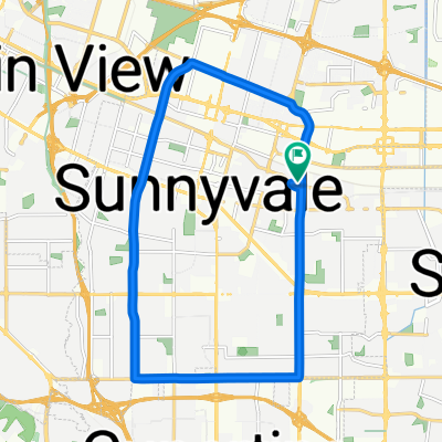
A cycling route starting in Sunnyvale, California, United States of America.
Overview
About this route
Primary goal is to minimize number of stoplights, potentially adding 0.1 mi here and there in order to almost eliminate stops.
Avoiding major roads/significant traffic is NOT a goal.
Key points:
Use Central Expressway to avoid stoplights at:
Maude/Pastoria
Maude/Mathilda
Maude/Borregas
Maude/Sunnyvale
Maude/Fair Oaks
Worlfe/Arques
Arques/Commercial
Lawrence/Kifer
Cost: 0.6mi
Cut across from Pastoria to Soquel two buildings north of Central. Come out further from the Indio/Soquel/Central merge, which makes the left on Indio a little safer. Also saves 0.13mi
Avoid the stoplight at California/Mathilda with the California/Sobrante/Central merge. Cost: 0.21mi - This one is questionable. <!>
Exit before the Central/Lawrence merge. Use Commercial to avoid stoplight at Lawrence/Kifer and save 0.06mi
Turning left across Lawrence Expressway on Monroe is not fun - proceed with caution. But using Nobili avoids 3 stoplights and saves 0.35mi compared with Lawrence-El Camino Real - Pomeroy
Crowley/Wallace/Benton/White avoid a stoplight at Kiely/Benton and Kiely/Kaiser. Cost: 0.09mi
Unavoidable STOPLIGHT at Homestead
Use Tanoak to avoid stoplight at Forbes and Pruneridge Cost: 0.1mi
STOPLGIHTS at:
San Tomas/Saratoga
San Tomas/Stevens Creek
San Tomas/Moorpark
San Tomas/Left onto Williams
10.7 miles, 7 stoplights
- -:--
- Duration
- 17.2 km
- Distance
- 48 m
- Ascent
- 14 m
- Descent
- ---
- Avg. speed
- ---
- Max. altitude

Part of
Minimize Stoplights - South Bay
2 stages
Route quality
Waytypes & surfaces along the route
Waytypes
Quiet road
7.5 km
(44 %)
Busy road
4.3 km
(25 %)
Surfaces
Paved
11.9 km
(69 %)
Asphalt
10.9 km
(63 %)
Paved (undefined)
0.9 km
(5 %)
Continue with Bikemap
Use, edit, or download this cycling route
You would like to ride LinkedIn/North Sunnyvale to Campbell or customize it for your own trip? Here is what you can do with this Bikemap route:
Free features
- Save this route as favorite or in collections
- Copy & plan your own version of this route
- Sync your route with Garmin or Wahoo
Premium features
Free trial for 3 days, or one-time payment. More about Bikemap Premium.
- Navigate this route on iOS & Android
- Export a GPX / KML file of this route
- Create your custom printout (try it for free)
- Download this route for offline navigation
Discover more Premium features.
Get Bikemap PremiumFrom our community
Other popular routes starting in Sunnyvale
 Stevens Creek - NASA - drive
- Distance
- 24.8 km
- Ascent
- 90 m
- Descent
- 92 m
- Location
- Sunnyvale, California, United States of America
 From San Jose to Sunnyvale
- Distance
- 22.1 km
- Ascent
- 58 m
- Descent
- 56 m
- Location
- Sunnyvale, California, United States of America
 Sunnyvale Evelyn - Stevens Creek Trail - Stevens Creek Reservoir - Hwy 9 - Prospect - Mary - Mathilda
- Distance
- 45.9 km
- Ascent
- 503 m
- Descent
- 495 m
- Location
- Sunnyvale, California, United States of America
 Montebello Rd - Black mountain
- Distance
- 19 km
- Ascent
- 815 m
- Descent
- 83 m
- Location
- Sunnyvale, California, United States of America
 Evelyn & Wolfe, Sunnyvale to South Wolfe Road 175, Sunnyvale
- Distance
- 17.5 km
- Ascent
- 79 m
- Descent
- 79 m
- Location
- Sunnyvale, California, United States of America
 Sunnyvale-Saratoga loop
- Distance
- 41.5 km
- Ascent
- 445 m
- Descent
- 418 m
- Location
- Sunnyvale, California, United States of America
 Sunnyvale - Saratoga loop through Big Basin Way
- Distance
- 35.4 km
- Ascent
- 296 m
- Descent
- 293 m
- Location
- Sunnyvale, California, United States of America
 Sunnyvale-Mountain View-Stevens Creek-Stevens Canyon Road
- Distance
- 51.6 km
- Ascent
- 408 m
- Descent
- 406 m
- Location
- Sunnyvale, California, United States of America
Open it in the app