

IRONMAN Maastricht-Limburg 2017 Official Bike Course
A cycling route starting in Maastricht, Limburg, The Netherlands.
Overview
About this route
Measured as follows:
(2x 89 km.) 178 km. 1120 hm elevation.
(This has been hand measured)
- -:--
- Duration
- 88.9 km
- Distance
- 381 m
- Ascent
- 381 m
- Descent
- ---
- Avg. speed
- ---
- Max. altitude

Route quality
Waytypes & surfaces along the route
Waytypes
Quiet road
31.1 km
(35 %)
Access road
17.8 km
(20 %)
Surfaces
Paved
51.6 km
(58 %)
Asphalt
42.7 km
(48 %)
Concrete
8 km
(9 %)
Route highlights
Points of interest along the route
Drinking water after 3.7 km
Aid station 1 - Severenstraat
Drinking water after 59.6 km
Aid station 4 - Waltwilder
Bike service after 88.8 km
Transition Area (Bike service)
Continue with Bikemap
Use, edit, or download this cycling route
You would like to ride IRONMAN Maastricht-Limburg 2017 Official Bike Course or customize it for your own trip? Here is what you can do with this Bikemap route:
Free features
- Save this route as favorite or in collections
- Copy & plan your own version of this route
- Split it into stages to create a multi-day tour
- Sync your route with Garmin or Wahoo
Premium features
Free trial for 3 days, or one-time payment. More about Bikemap Premium.
- Navigate this route on iOS & Android
- Export a GPX / KML file of this route
- Create your custom printout (try it for free)
- Download this route for offline navigation
Discover more Premium features.
Get Bikemap PremiumFrom our community
Other popular routes starting in Maastricht
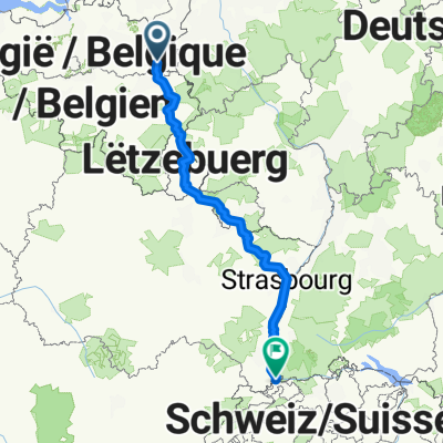 From Maastricht to Luxembourg
- Distance
- 586.9 km
- Ascent
- 6,060 m
- Descent
- 5,836 m
- Location
- Maastricht, Limburg, The Netherlands
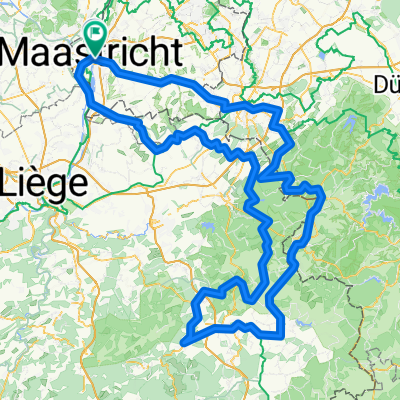
 2025-09-07 Maastricht - Vroenhoven - Val-meer - Millen - Genoelselderen - Membruggen - Rijkhoven - Kleine Spouwen - Rosmeer - Hees - Vroenhoven - Maastricht
- Distance
- 50.5 km
- Ascent
- 349 m
- Descent
- 349 m
- Location
- Maastricht, Limburg, The Netherlands
 From Maastricht to Waimes
- Distance
- 238.8 km
- Ascent
- 2,408 m
- Descent
- 2,409 m
- Location
- Maastricht, Limburg, The Netherlands
 Vennradweg Etappe 4
- Distance
- 48.1 km
- Ascent
- 41 m
- Descent
- 71 m
- Location
- Maastricht, Limburg, The Netherlands
 ADFC-Vise-DR3
- Distance
- 44 km
- Ascent
- 484 m
- Descent
- 484 m
- Location
- Maastricht, Limburg, The Netherlands
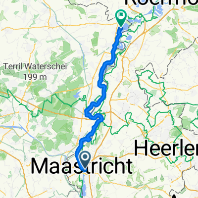
 IRONMAN Maastricht-Limburg 2016
- Distance
- 90.2 km
- Ascent
- 363 m
- Descent
- 360 m
- Location
- Maastricht, Limburg, The Netherlands
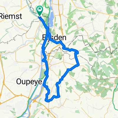
 Vroenhoven Kanne Observant
- Distance
- 23 km
- Ascent
- 303 m
- Descent
- 301 m
- Location
- Maastricht, Limburg, The Netherlands
![[DAY 1] Maastricht - Liège](https://media.bikemap.net/routes/8405473/gallery/thumbs/9a980660-2471-4b6d-a1ba-a822b9669b38.jpg.208x208_q80_crop.jpg) [DAY 1] Maastricht - Liège
[DAY 1] Maastricht - Liège- Distance
- 32.9 km
- Ascent
- 58 m
- Descent
- 38 m
- Location
- Maastricht, Limburg, The Netherlands
Open it in the app