

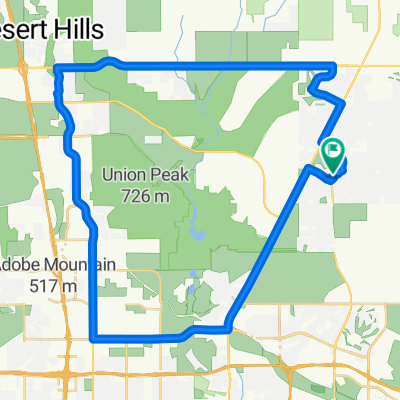
N Scottsdale Tour Loop (part 3)
A cycling route starting in Cave Creek, Arizona, United States of America.
Overview
About this route
- -:--
- Duration
- 26.7 km
- Distance
- 29 m
- Ascent
- 130 m
- Descent
- ---
- Avg. speed
- ---
- Max. altitude

Route quality
Waytypes & surfaces along the route
Waytypes
Busy road
9.8 km
(37 %)
Path
8.4 km
(32 %)
Surfaces
Paved
15.8 km
(59 %)
Unpaved
10.9 km
(41 %)
Asphalt
12.4 km
(46 %)
Ground
10.9 km
(41 %)
Continue with Bikemap
Use, edit, or download this cycling route
You would like to ride N Scottsdale Tour Loop (part 3) or customize it for your own trip? Here is what you can do with this Bikemap route:
Free features
- Save this route as favorite or in collections
- Copy & plan your own version of this route
- Sync your route with Garmin or Wahoo
Premium features
Free trial for 3 days, or one-time payment. More about Bikemap Premium.
- Navigate this route on iOS & Android
- Export a GPX / KML file of this route
- Create your custom printout (try it for free)
- Download this route for offline navigation
Discover more Premium features.
Get Bikemap PremiumFrom our community
Other popular routes starting in Cave Creek
 N Scottsdale Tour Loop (part 3)
- Distance
- 26.7 km
- Ascent
- 29 m
- Descent
- 130 m
- Location
- Cave Creek, Arizona, United States of America
 Recovered Route
- Distance
- 10.2 km
- Ascent
- 103 m
- Descent
- 23 m
- Location
- Cave Creek, Arizona, United States of America
 Recovered Route
- Distance
- 19 km
- Ascent
- 103 m
- Descent
- 105 m
- Location
- Cave Creek, Arizona, United States of America
 East Sonoran Desert Drive 1600, Phoenix to East Sonoran Desert Drive 1600, Phoenix
- Distance
- 15 km
- Ascent
- 24 m
- Descent
- 29 m
- Location
- Cave Creek, Arizona, United States of America
 33750 N Dove Lakes Dr, Phoenix to 4402 E Smokehouse Trail, Phoenix
- Distance
- 30.5 km
- Ascent
- 145 m
- Descent
- 156 m
- Location
- Cave Creek, Arizona, United States of America
 Route 1 desert trail
- Distance
- 5.5 km
- Ascent
- 0 m
- Descent
- 4 m
- Location
- Cave Creek, Arizona, United States of America
 ocotillo trail Apache Wash
- Distance
- 16.9 km
- Ascent
- 144 m
- Descent
- 146 m
- Location
- Cave Creek, Arizona, United States of America
 Airport Loop - Carefree Hwy Return
- Distance
- 50.8 km
- Ascent
- 202 m
- Descent
- 202 m
- Location
- Cave Creek, Arizona, United States of America
Open it in the app