

Gotthard Challenge
A cycling route starting in Andermatt, Canton of Uri, Switzerland.
Overview
About this route
With three legendary passes that regularly feature in the Tour de Suisse, this loop ranks among the great alpine classics. Although just 106km in length, it should not be underestimated: with almost 40km of climbing, it presents a major challenge.
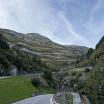
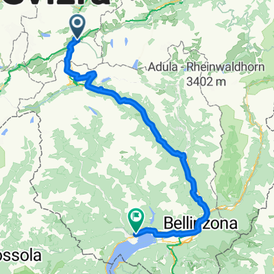
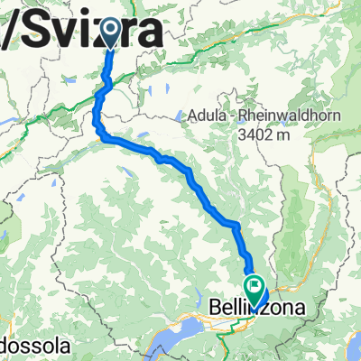
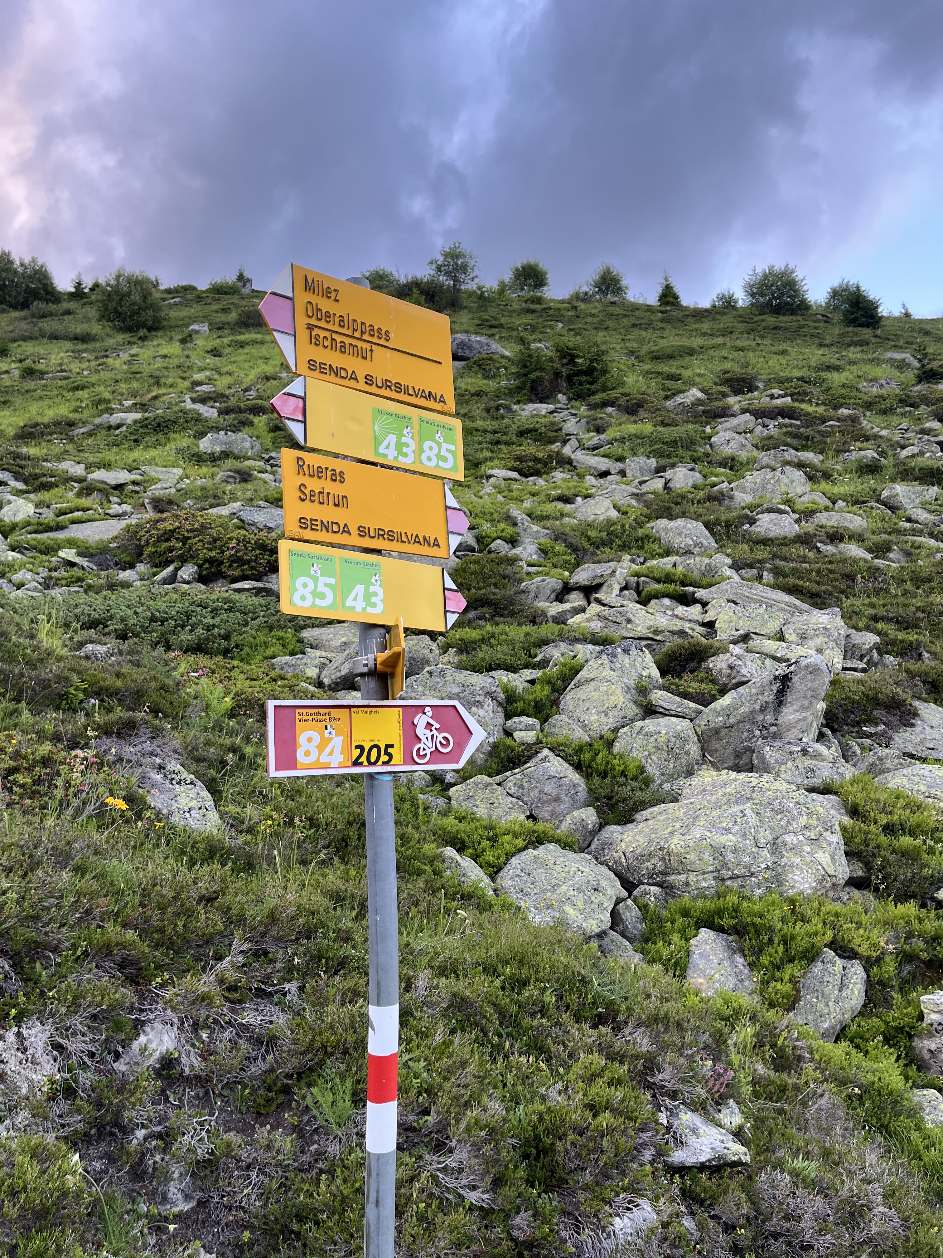
Starting in Andermatt in Canton Uri, the first pass is the Furka: 11km of climbing to reach the summit at alt. 2436m. You then enter Canton Valais for the long descent to Gletsch followed by Ulrichen in the Upper Rhone valley, known locally as the Goms. Time to think of taking food and drink on board, since you are about to make the ascent to the Nufenen pass (alt. 2478m) after 13km of climbing punctuated by long straights over 10% in gradient. Featuring Switzerland’s second-highest metalled pass road (only the Umbrail is higher), the Nufenen is a challenge in itself. The summit marks the gateway to another of Switzerland’s cantons: Ticino. There now follows a marvellous, extended descent towards Italian-speaking Airolo, where the day’s third and final ascent starts to the Gotthard at alt. 2091m. The world’s fourth-longest road tunnel swallows most of the north-south traffic; what is left takes the main pass road. Cyclists climb the ancient road, call the Tremola. Uniquely for the Alps, its 24 upper hairpin bends feature cobblestones. Enough to make you forget the 3000m-plus of difference in altitude you have been climbing today. Once at the top, Andermatt is no more than a few kilometres further on (and down!). Time for a well-earned rest in this quintessential village in the heart of the Swiss Alps.
- -:--
- Duration
- 105.9 km
- Distance
- 3,023 m
- Ascent
- 3,021 m
- Descent
- ---
- Avg. speed
- ---
- Max. altitude

Route quality
Waytypes & surfaces along the route
Waytypes
Quiet road
4.2 km
(4 %)
Track
2.1 km
(2 %)
Surfaces
Paved
94.3 km
(89 %)
Asphalt
92.2 km
(87 %)
Paved (undefined)
1.1 km
(1 %)
Continue with Bikemap
Use, edit, or download this cycling route
You would like to ride Gotthard Challenge or customize it for your own trip? Here is what you can do with this Bikemap route:
Free features
- Save this route as favorite or in collections
- Copy & plan your own version of this route
- Split it into stages to create a multi-day tour
- Sync your route with Garmin or Wahoo
Premium features
Free trial for 3 days, or one-time payment. More about Bikemap Premium.
- Navigate this route on iOS & Android
- Export a GPX / KML file of this route
- Create your custom printout (try it for free)
- Download this route for offline navigation
Discover more Premium features.
Get Bikemap PremiumFrom our community
Other popular routes starting in Andermatt
 Furkastrasse, Realp nach Ritystrasse, Brigerbad
- Distance
- 70.6 km
- Ascent
- 558 m
- Descent
- 2,246 m
- Location
- Andermatt, Canton of Uri, Switzerland
 Von Andermatt bis Locarno
- Distance
- 115.9 km
- Ascent
- 2,182 m
- Descent
- 3,407 m
- Location
- Andermatt, Canton of Uri, Switzerland
 Tag 3: Andermatt - Bellinzona
- Distance
- 100 km
- Ascent
- 2,518 m
- Descent
- 3,216 m
- Location
- Andermatt, Canton of Uri, Switzerland
 Oberalppass nach Sedrun,Oberalpbike Route 205/84
- Distance
- 17.3 km
- Ascent
- 593 m
- Descent
- 1,193 m
- Location
- Andermatt, Canton of Uri, Switzerland
 Bellinzona - Vizzola Ticino
- Distance
- 130.7 km
- Ascent
- 2,639 m
- Descent
- 3,799 m
- Location
- Andermatt, Canton of Uri, Switzerland
 Tag 3: Göschenen - Giubiasco (Bellinzona)
- Distance
- 105.5 km
- Ascent
- 1,280 m
- Descent
- 2,197 m
- Location
- Andermatt, Canton of Uri, Switzerland
 VR01 Furkapass Belvedere-Brig.kml - VR01 Furkapass Belvedere-Brig.kml_VR01 Furkapass Belvedere-Brig
- Distance
- 60.1 km
- Ascent
- 852 m
- Descent
- 2,409 m
- Location
- Andermatt, Canton of Uri, Switzerland
 NL The Rhine Cycle Route
- Distance
- 1,352.1 km
- Ascent
- 88 m
- Descent
- 1,523 m
- Location
- Andermatt, Canton of Uri, Switzerland
Open it in the app