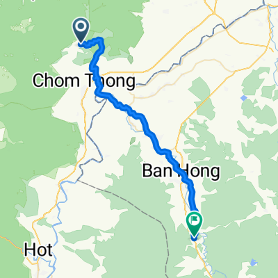
Lengthy ride through Ban Phonsawan
A cycling route starting in Chom Thong, Chiang Mai Province, Thailand.
Overview
About this route
- 6 h 4 min
- Duration
- 34.7 km
- Distance
- 1,141 m
- Ascent
- 202 m
- Descent
- 5.7 km/h
- Avg. speed
- ---
- Avg. speed
Route quality
Waytypes & surfaces along the route
Waytypes
Busy road
28.1 km
(81 %)
Access road
4.3 km
(12 %)
Surfaces
Paved
32.9 km
(95 %)
Asphalt
28.3 km
(82 %)
Paved (undefined)
4 km
(11 %)
Continue with Bikemap
Use, edit, or download this cycling route
You would like to ride Lengthy ride through Ban Phonsawan or customize it for your own trip? Here is what you can do with this Bikemap route:
Free features
- Save this route as favorite or in collections
- Copy & plan your own version of this route
- Sync your route with Garmin or Wahoo
Premium features
Free trial for 3 days, or one-time payment. More about Bikemap Premium.
- Navigate this route on iOS & Android
- Export a GPX / KML file of this route
- Create your custom printout (try it for free)
- Download this route for offline navigation
Discover more Premium features.
Get Bikemap PremiumFrom our community
Other popular routes starting in Chom Thong
- Tag5
- Distance
- 86.4 km
- Ascent
- 2,301 m
- Descent
- 2,272 m
- Location
- Chom Thong, Chiang Mai Province, Thailand
- Mae Hong Son Hills 6b
- Distance
- 134.9 km
- Ascent
- 2,371 m
- Descent
- 2,364 m
- Location
- Chom Thong, Chiang Mai Province, Thailand
- Doi Inthanon KOM
- Distance
- 46.7 km
- Ascent
- 2,354 m
- Descent
- 83 m
- Location
- Chom Thong, Chiang Mai Province, Thailand
- Ithanon - Mae Chaem
- Distance
- 60.8 km
- Ascent
- 1,482 m
- Descent
- 1,294 m
- Location
- Chom Thong, Chiang Mai Province, Thailand
- nach chiang mai 2 ter Tag
- Distance
- 47.2 km
- Ascent
- 128 m
- Descent
- 74 m
- Location
- Chom Thong, Chiang Mai Province, Thailand
- Lengthy ride through Ban Phonsawan
- Distance
- 34.7 km
- Ascent
- 1,141 m
- Descent
- 202 m
- Location
- Chom Thong, Chiang Mai Province, Thailand
- tag 2 nach chiang mai
- Distance
- 82.3 km
- Ascent
- 353 m
- Descent
- 190 m
- Location
- Chom Thong, Chiang Mai Province, Thailand
- Mae Klang Luang -
- Distance
- 113.6 km
- Ascent
- 1,331 m
- Descent
- 2,031 m
- Location
- Chom Thong, Chiang Mai Province, Thailand
Open it in the app