

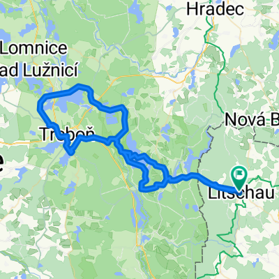
Litschau - Bad Eisenkappel
A cycling route starting in Litschau, Lower Austria, Austria.
Overview
About this route
Litschau - Gmünd - Arbesbach - Grein - Waidhofen an der Ybbs - Weyer - Admont - Kaiserau - Hohentauern - Unzmarkt - Hüttenberg - Völkermarkt - Bad Eisenkappel
- -:--
- Duration
- 379 km
- Distance
- 2,493 m
- Ascent
- 2,470 m
- Descent
- ---
- Avg. speed
- ---
- Max. altitude
Route quality
Waytypes & surfaces along the route
Waytypes
Quiet road
56.9 km
(15 %)
Road
41.7 km
(11 %)
Surfaces
Paved
223.6 km
(59 %)
Unpaved
19 km
(5 %)
Asphalt
216 km
(57 %)
Paved (undefined)
7.6 km
(2 %)
Continue with Bikemap
Use, edit, or download this cycling route
You would like to ride Litschau - Bad Eisenkappel or customize it for your own trip? Here is what you can do with this Bikemap route:
Free features
- Save this route as favorite or in collections
- Copy & plan your own version of this route
- Split it into stages to create a multi-day tour
- Sync your route with Garmin or Wahoo
Premium features
Free trial for 3 days, or one-time payment. More about Bikemap Premium.
- Navigate this route on iOS & Android
- Export a GPX / KML file of this route
- Create your custom printout (try it for free)
- Download this route for offline navigation
Discover more Premium features.
Get Bikemap PremiumFrom our community
Other popular routes starting in Litschau
 Eulenberg Strecke (Start Gopprechts)
- Distance
- 35.1 km
- Ascent
- 297 m
- Descent
- 298 m
- Location
- Litschau, Lower Austria, Austria
 Litschau-Trebon-Hluboka-Budweis-Variante2.0
- Distance
- 75 km
- Ascent
- 277 m
- Descent
- 416 m
- Location
- Litschau, Lower Austria, Austria
 Litschau-Steinhübel-Strecke
- Distance
- 33.9 km
- Ascent
- 467 m
- Descent
- 467 m
- Location
- Litschau, Lower Austria, Austria
 2013 Litschau
- Distance
- 54 km
- Ascent
- 492 m
- Descent
- 491 m
- Location
- Litschau, Lower Austria, Austria
 Eisenman LITSCHAU 28 km
- Distance
- 26.9 km
- Ascent
- 307 m
- Descent
- 343 m
- Location
- Litschau, Lower Austria, Austria
 Waldviertel Eulenberg (16)
- Distance
- 41.2 km
- Ascent
- 371 m
- Descent
- 371 m
- Location
- Litschau, Lower Austria, Austria
 zum Nordkap über CZ
- Distance
- 55.5 km
- Ascent
- 405 m
- Descent
- 405 m
- Location
- Litschau, Lower Austria, Austria
 100 Teiche Tour Litschau
- Distance
- 72.5 km
- Ascent
- 638 m
- Descent
- 638 m
- Location
- Litschau, Lower Austria, Austria
Open it in the app