

סינגל יער אחיהוד
A cycling route starting in Kabul, Northern District, Israel.
Overview
About this route
The Achihud Forest mountain bike singletrack offers us the best of all the worlds surrounding it – a green that hurts the eyes, the blue sea stretching out in the distance, fast and winding flow, challenging rock steps both downhill and uphill, and a healthy fitness workout.
- Show titles only
Directions
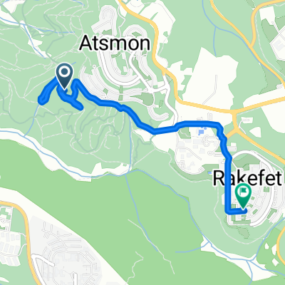
Gilon trailhead – On Highway 85, about 6 km east of the Achihud junction, turn north at the Gilon junction towards the gas station, then immediately left onto the Achihud Forest scenic route marked with green trail signs. After about 300 m, turn left into a large, spacious parking lot. Parking is also possible at the gas station, bike up the scenic route, and immediately merge left onto the singletrack. Tel-El trailhead – On Highway 70, about 2.5 km north of the Yassif junction, turn east toward the Tel-El settlement. Before the settlement gate, turn right into a parking lot. Yassif Junction trailhead – On Highway 70, about 300 m north of the Yassif junction, turn right onto the road marked with green trail markers, ride about 400 m, and park.
Route description
The singletrack flows westward down the slope of the mythical Mount Camel, ascends north to the Tel-El settlement, and returns eastward passing along a scenic trail carved into the northern face of the ridge, a beautiful terrain usually hidden from public view. The trail may tempt us to fly at apparently illegal speeds from time to time, but remember that behind every turn there may be a small step or another curve. Be sure to maintain a speed appropriate to your riding level, one that allows you to safely overcome any surprise on the trail. Route details – length: 21 km, total elevation gain: 420 m, riding level: intermediate. The singletrack is marked on the ground with yellow 'drops' containing a black cyclist. The tip of the drops indicates the direction of travel, and riding is only allowed in the marked direction – clockwise. It is possible to shorten the route by 3.5 km (details in the route story).
Route story
From the Gilon trailhead – we start westward on the trail down the southern slope of Mount Camel. Very soon we leave the scenic route and enter a singletrack cruising through open green and blooming areas to an enchanted forest. After a light warm-up climb, we enjoy a continuous 3.5 km section of thrilling descent, and spectacular views of the Hilazon Stream valley and Haifa Bay assault us every time a gap opens between the trees. Along the way, we can notice an impressive observation tower used to warn of fires during the hot season. We continue savoring the path going west, slightly climbing and descending, and finally ascending to the top of Yisoor Hill, where the Yisoor settlement was originally founded in the valley. From there, we glide with shouts of joy north until we meet the scenic route at the Yassif Junction trailhead. The singletrack again climbs, this time with dispersed rock steps along the ascent challenging us just enough. At some point, the ascent softens, even becoming a slight descent, and after a few more meters of climbing, the singletrack borders the road by a stone fence and gate. Here it is possible to shorten the route by 3.5 km – pass through the gate in the fence, turn right (east), and immediately right again to continue the singletrack. This shortcut is not suitable for those who started from Tel-El. If not shortening, we continue here with the singletrack and soon find ourselves flowing and challenged on the most technical descent of the route, ending near the access road to Tel-El. Here we pass by an old quarry with a beautiful cave and commemorative pillars of KKL donors. Near the Tel-El settlement fence, we see a left split of the singletrack leading to the Tel-El trailhead. Those who start riding from this trailhead will climb the short path and immediately turn left to join the singletrack. Now comes the payment phase for all the descents on the route – a long climb back up Mount Camel. But the very smart and very gentle construction of the singletrack and the stunning views opening up while riding on the open mountain slope make all the effort forgotten and promise an experience no less enjoyable than the descent. After the summit, with views of a small spur to the north revealing a spectacular and unknown angle of Mount Camel, we return to the southern slope of the mountain and finish with a thrilling descent back to the Gilon trailhead. Those who started at the other trailheads will continue with the singletrack as described above.
- -:--
- Duration
- 20.7 km
- Distance
- 366 m
- Ascent
- 366 m
- Descent
- ---
- Avg. speed
- ---
- Max. altitude

Route quality
Waytypes & surfaces along the route
Waytypes
Path
18.4 km
(89 %)
Track
1.7 km
(8 %)
Access road
0.6 km
(3 %)
Surfaces
Paved
0.2 km
(1 %)
Paved (undefined)
0.2 km
(1 %)
Undefined
20.5 km
(99 %)
Continue with Bikemap
Use, edit, or download this cycling route
You would like to ride סינגל יער אחיהוד or customize it for your own trip? Here is what you can do with this Bikemap route:
Free features
- Save this route as favorite or in collections
- Copy & plan your own version of this route
- Sync your route with Garmin or Wahoo
Premium features
Free trial for 3 days, or one-time payment. More about Bikemap Premium.
- Navigate this route on iOS & Android
- Export a GPX / KML file of this route
- Create your custom printout (try it for free)
- Download this route for offline navigation
Discover more Premium features.
Get Bikemap PremiumFrom our community
Other popular routes starting in Kabul
 bike tour from (null) to (null)
- Distance
- 14.4 km
- Ascent
- 390 m
- Descent
- 390 m
- Location
- Kabul, Northern District, Israel
 Derech HaPashosh to Atsmon Segev
- Distance
- 115.8 km
- Ascent
- 0 m
- Descent
- 0 m
- Location
- Kabul, Northern District, Israel
 ride from (null) to (null)
- Distance
- 18.2 km
- Ascent
- 334 m
- Descent
- 338 m
- Location
- Kabul, Northern District, Israel
 От כביש 805 до Tamra
- Distance
- 25.8 km
- Ascent
- 398 m
- Descent
- 468 m
- Location
- Kabul, Northern District, Israel
 דרך האנפה 277, עצמון שגב to דרך ללא שם, מצפה רמון
- Distance
- 402.2 km
- Ascent
- 4,524 m
- Descent
- 4,013 m
- Location
- Kabul, Northern District, Israel
 От כביש 805 до כביש 805
- Distance
- 14.7 km
- Ascent
- 885 m
- Descent
- 877 m
- Location
- Kabul, Northern District, Israel
 Restful route in Shechaniya
- Distance
- 4.8 km
- Ascent
- 341 m
- Descent
- 16 m
- Location
- Kabul, Northern District, Israel
 Steady ride
- Distance
- 5 km
- Ascent
- 140 m
- Descent
- 107 m
- Location
- Kabul, Northern District, Israel
Open it in the app