

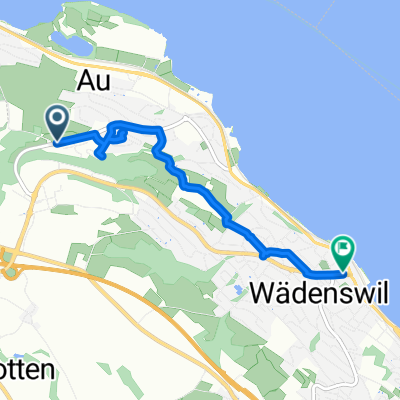
Wädenswil- Rhein-Brugg
A cycling route starting in Au, Canton of Zurich, Switzerland.
Overview
About this route
From Wädenswil to Zurich-Dielsdorf-Kaiserstuhl-Klingnau reservoir up to Brugg.
- -:--
- Duration
- 89.2 km
- Distance
- 291 m
- Ascent
- 502 m
- Descent
- ---
- Avg. speed
- ---
- Max. altitude

Route quality
Waytypes & surfaces along the route
Waytypes
Quiet road
20.5 km
(23 %)
Road
15.2 km
(17 %)
Surfaces
Paved
78.5 km
(88 %)
Unpaved
3.6 km
(4 %)
Asphalt
77.6 km
(87 %)
Gravel
3.6 km
(4 %)
Continue with Bikemap
Use, edit, or download this cycling route
You would like to ride Wädenswil- Rhein-Brugg or customize it for your own trip? Here is what you can do with this Bikemap route:
Free features
- Save this route as favorite or in collections
- Copy & plan your own version of this route
- Split it into stages to create a multi-day tour
- Sync your route with Garmin or Wahoo
Premium features
Free trial for 3 days, or one-time payment. More about Bikemap Premium.
- Navigate this route on iOS & Android
- Export a GPX / KML file of this route
- Create your custom printout (try it for free)
- Download this route for offline navigation
Discover more Premium features.
Get Bikemap PremiumFrom our community
Other popular routes starting in Au
 Wädi nach Züri
- Distance
- 25.5 km
- Ascent
- 272 m
- Descent
- 396 m
- Location
- Au, Canton of Zurich, Switzerland
 Wädenswil- Rhein-Brugg
- Distance
- 89.2 km
- Ascent
- 291 m
- Descent
- 502 m
- Location
- Au, Canton of Zurich, Switzerland
 CH-Voralpen'14: Hirzel - Aegeri - Schwyz - Ibergeregg - Etzel
- Distance
- 95.9 km
- Ascent
- 1,486 m
- Descent
- 1,482 m
- Location
- Au, Canton of Zurich, Switzerland
 yokus
yokus- Distance
- 3 km
- Ascent
- 0 m
- Descent
- 146 m
- Location
- Au, Canton of Zurich, Switzerland
 Rütistrasse, Wädenswil to Rosengartenstrasse 4, Richterswil
- Distance
- 13.6 km
- Ascent
- 220 m
- Descent
- 361 m
- Location
- Au, Canton of Zurich, Switzerland
 Winterbergstrasse 6, Au ZH nach Hintercher 1, Menzingen
- Distance
- 12.9 km
- Ascent
- 483 m
- Descent
- 244 m
- Location
- Au, Canton of Zurich, Switzerland
 Einsiedlerstrasse, Horgen nach Bachtelstrasse 18, Horgen
- Distance
- 22.3 km
- Ascent
- 192 m
- Descent
- 236 m
- Location
- Au, Canton of Zurich, Switzerland
 Steinacherstrasse, Au ZH to Seestrasse, Wädenswil
- Distance
- 4.7 km
- Ascent
- 46 m
- Descent
- 162 m
- Location
- Au, Canton of Zurich, Switzerland
Open it in the app