

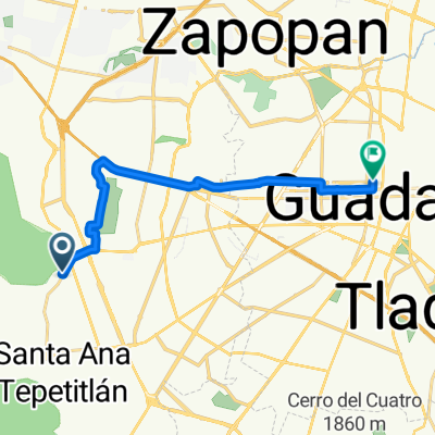
RioCaliente
A cycling route starting in Palomar, Jalisco, Mexico.
Overview
About this route
- -:--
- Duration
- 41.1 km
- Distance
- 874 m
- Ascent
- 874 m
- Descent
- ---
- Avg. speed
- ---
- Max. altitude

Route quality
Waytypes & surfaces along the route
Waytypes
Quiet road
25.9 km
(63 %)
Track
11.9 km
(29 %)
Path
3.3 km
(8 %)
Surfaces
Unpaved
35 km
(85 %)
Ground
35 km
(85 %)
Undefined
6.2 km
(15 %)
Route highlights
Points of interest along the route
Point of interest after 3.2 km
Torre 2
Point of interest after 3.8 km
Mosa
Point of interest after 5.4 km
Vaca Muerta
Point of interest after 6.2 km
Garrison
Point of interest after 6.8 km
Toboganes
Point of interest after 7.1 km
Angel
Point of interest after 7.7 km
Torre 1
Point of interest after 20.6 km
Paraje Rio Caliente
Continue with Bikemap
Use, edit, or download this cycling route
You would like to ride RioCaliente or customize it for your own trip? Here is what you can do with this Bikemap route:
Free features
- Save this route as favorite or in collections
- Copy & plan your own version of this route
- Sync your route with Garmin or Wahoo
Premium features
Free trial for 3 days, or one-time payment. More about Bikemap Premium.
- Navigate this route on iOS & Android
- Export a GPX / KML file of this route
- Create your custom printout (try it for free)
- Download this route for offline navigation
Discover more Premium features.
Get Bikemap PremiumFrom our community
Other popular routes starting in Palomar
 tekuan mosca harrison toboganes hermo
- Distance
- 16 km
- Ascent
- 1,348 m
- Descent
- 1,380 m
- Location
- Palomar, Jalisco, Mexico
 primavera hermosisima
- Distance
- 19.6 km
- Ascent
- 388 m
- Descent
- 387 m
- Location
- Palomar, Jalisco, Mexico
 Postes-Torre2-Mosca-Garrison-Toboganes-Hermosisima-VacaMuerta
- Distance
- 41.4 km
- Ascent
- 783 m
- Descent
- 785 m
- Location
- Palomar, Jalisco, Mexico
 RioCaliente
- Distance
- 41.1 km
- Ascent
- 874 m
- Descent
- 874 m
- Location
- Palomar, Jalisco, Mexico
 De Prolongación Mariano Otero a Prolongación Mariano Otero
- Distance
- 16 km
- Ascent
- 522 m
- Descent
- 531 m
- Location
- Palomar, Jalisco, Mexico
 De Paseo de los Padres MZ21LT17, Zapopan a Calle Magnolia 57a, Zapopan
- Distance
- 3.4 km
- Ascent
- 17 m
- Descent
- 0 m
- Location
- Palomar, Jalisco, Mexico
 Calle Gredilla, Zapopan a Calle Garibaldi, Guadalajara
- Distance
- 15.4 km
- Ascent
- 72 m
- Descent
- 195 m
- Location
- Palomar, Jalisco, Mexico
 árbol y torre 1 corto
- Distance
- 11.3 km
- Ascent
- 323 m
- Descent
- 322 m
- Location
- Palomar, Jalisco, Mexico
Open it in the app