

Die Großglockner Hochalpenstraße
A cycling route starting in Bruck an der Großglocknerstraße, Salzburg, Austria.
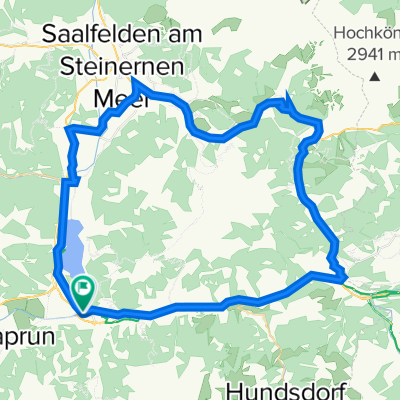
Overview
About this route
Die Route führt von Bruck aus über den Großglockner, an Heiligenblut vorbei ins Mölltal. Bei Obervellach wartet noch einmal ein 8-km- Anstieg bis nach Mallnitz (ÖBB- Tauernschleuse)
Die Höhepunkte der Route sind sicherlich das Erreichen des Fuscher Törls und die Ankunft am Hochtor. Herrliche Aussicht, eine sehr gut ausgebaute Straße und relativ konstante Steigung machen die Bergfahrt zu einem unvergesslichen Erlebnis. Hinzu kommt noch das Gefühl, als einer der wenigen nur mit Muskelkraft ganz oben angekommen zu sein.
Abfahrt ähnlich, ein Traum in Serpentinen.
Das Mölltal 'zieht' sich zwar ein wenig, ist aber landschaftlich und straßenbautechnisch nicht weniger reizvoll.
Zu guter Letzt: Anstieg nach Mallnitz, mit dem Glockner in den Beinen darf man hier noch etwas 'beißen'.
Fazit: Landschaftlich traumhaft schön, allerdings sollte man davor schon ein paar Hügel in den Wadeln haben!
- -:--
- Duration
- 108.7 km
- Distance
- 3,168 m
- Ascent
- 2,923 m
- Descent
- ---
- Avg. speed
- 2,521 m
- Avg. speed

Route quality
Waytypes & surfaces along the route
Waytypes
Busy road
55.7 km
(51 %)
Road
45.7 km
(42 %)
Surfaces
Paved
79.4 km
(73 %)
Unpaved
0.2 km
(<1 %)
Asphalt
79.1 km
(73 %)
Paving stones
0.3 km
(<1 %)
Continue with Bikemap
Use, edit, or download this cycling route
You would like to ride Die Großglockner Hochalpenstraße or customize it for your own trip? Here is what you can do with this Bikemap route:
Free features
- Save this route as favorite or in collections
- Copy & plan your own version of this route
- Split it into stages to create a multi-day tour
- Sync your route with Garmin or Wahoo
Premium features
Free trial for 3 days, or one-time payment. More about Bikemap Premium.
- Navigate this route on iOS & Android
- Export a GPX / KML file of this route
- Create your custom printout (try it for free)
- Download this route for offline navigation
Discover more Premium features.
Get Bikemap PremiumFrom our community
Other popular routes starting in Bruck an der Großglocknerstraße
 Glocknerkönig
- Distance
- 27.3 km
- Ascent
- 1,699 m
- Descent
- 222 m
- Location
- Bruck an der Großglocknerstraße, Salzburg, Austria
 Großglockner (Fusch - Heiligenblut)
- Distance
- 52.9 km
- Ascent
- 3,327 m
- Descent
- 1,850 m
- Location
- Bruck an der Großglocknerstraße, Salzburg, Austria
 Großklockner-Fuschertörl
- Distance
- 27 km
- Ascent
- 1,707 m
- Descent
- 225 m
- Location
- Bruck an der Großglocknerstraße, Salzburg, Austria
 Zell am See / Kaprun
- Distance
- 66.4 km
- Ascent
- 746 m
- Descent
- 747 m
- Location
- Bruck an der Großglocknerstraße, Salzburg, Austria
 Route in Bruck an der Großglocknerstraße
- Distance
- 49.6 km
- Ascent
- 584 m
- Descent
- 584 m
- Location
- Bruck an der Großglocknerstraße, Salzburg, Austria
 Großglockner
- Distance
- 98.2 km
- Ascent
- 4,734 m
- Descent
- 4,733 m
- Location
- Bruck an der Großglocknerstraße, Salzburg, Austria
 "Queralp" von Fusch an der Glocknerstrasse nach Bad Gastein
- Distance
- 78.9 km
- Ascent
- 2,909 m
- Descent
- 2,623 m
- Location
- Bruck an der Großglocknerstraße, Salzburg, Austria
 Über den Höchsten den wir haben
- Distance
- 48.5 km
- Ascent
- 2,373 m
- Descent
- 1,642 m
- Location
- Bruck an der Großglocknerstraße, Salzburg, Austria
Open it in the app