reggello-bonsi- marnia-pieve a pitiana-saltino-reggello
- 33.7 km
- 1,034 m
- 1,032 m
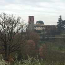
- Reggello, Tuscany, Italy
A cycling route starting in Reggello, Tuscany, Italy.
Overview
Reggello - Vallombrosa - Macinaia (sentiero 12) - Secchieta - S. Antonio dalla croce al cardeto (sentiero 15) - "reggellese" fino a imboccare l'erta di casagalli (sentiero 16) fino a Reggello.
created this 9 years ago
Route quality
Track
12.1 km
(34 %)
Path
7.1 km
(20 %)
Paved
12.9 km
(36 %)
Unpaved
15.4 km
(43 %)
Asphalt
10 km
(28 %)
Unpaved (undefined)
8.6 km
(24 %)
Continue with Bikemap
You would like to ride Tour del pratomagno, versante valdarnese or customize it for your own trip? Here is what you can do with this Bikemap route:
Free trial for 3 days, or one-time payment. More about Bikemap Premium.
Discover more Premium features.
Get Bikemap PremiumFrom our community
Open it in the app