

bike tour tagaytay Dec 11 2016
A cycling route starting in Tanauan, Calabarzon, Philippines.
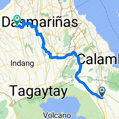
Overview
About this route
tanauan to sampalok sampalok to tagaytay tagtay to sungay sungay to tanauan
- 7 h 52 min
- Duration
- 64.8 km
- Distance
- 919 m
- Ascent
- 920 m
- Descent
- 8.2 km/h
- Avg. speed
- ---
- Max. altitude

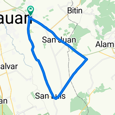
Route photos


Continue with Bikemap
Use, edit, or download this cycling route
You would like to ride bike tour tagaytay Dec 11 2016 or customize it for your own trip? Here is what you can do with this Bikemap route:
Free features
- Save this route as favorite or in collections
- Copy & plan your own version of this route
- Sync your route with Garmin or Wahoo
Premium features
Free trial for 3 days, or one-time payment. More about Bikemap Premium.
- Navigate this route on iOS & Android
- Export a GPX / KML file of this route
- Create your custom printout (try it for free)
- Download this route for offline navigation
Discover more Premium features.
Get Bikemap PremiumFrom our community
Other popular routes starting in Tanauan
 4524+3WG, Santo Tomas to 1, Alaminos
- Distance
- 11.7 km
- Ascent
- 64 m
- Descent
- 67 m
- Location
- Tanauan, Calabarzon, Philippines
 From Tanauan City to Tanza
- Distance
- 64.6 km
- Ascent
- 509 m
- Descent
- 597 m
- Location
- Tanauan, Calabarzon, Philippines
 Tagaytay-Tanauan Ride
- Distance
- 70 km
- Ascent
- 1,393 m
- Descent
- 1,393 m
- Location
- Tanauan, Calabarzon, Philippines
 San Pedro-Suloc-Bansulan Hills-Alaminos-San Pedro
- Distance
- 34 km
- Ascent
- 285 m
- Descent
- 283 m
- Location
- Tanauan, Calabarzon, Philippines
 Juan Villegas Street 3050, Santo Tomas to Juan Villegas Street 3050, Santo Tomas
- Distance
- 19.4 km
- Ascent
- 132 m
- Descent
- 135 m
- Location
- Tanauan, Calabarzon, Philippines
 goal to get her
- Distance
- 9.7 km
- Ascent
- 127 m
- Descent
- 21 m
- Location
- Tanauan, Calabarzon, Philippines
 taal loop
- Distance
- 118 km
- Ascent
- 1,659 m
- Descent
- 1,660 m
- Location
- Tanauan, Calabarzon, Philippines
 San Vicente to Sta. Cruz to Alaminos and back
- Distance
- 34.6 km
- Ascent
- 300 m
- Descent
- 295 m
- Location
- Tanauan, Calabarzon, Philippines
Open it in the app