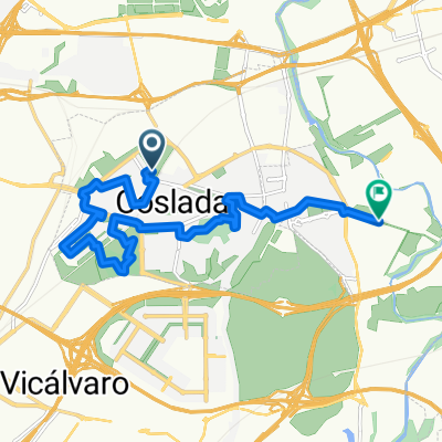
Coslada - Torres de la Alameda - Cerro de la Peluquera - Barranco del Monte Bajo - Torres de la Alameda - Coslada
A cycling route starting in Coslada, Madrid, Spain.
Overview
About this route
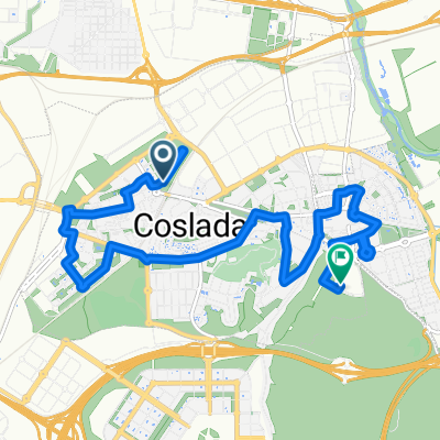
Una ruta con el aliciente de la subida al Cerro de la Peluquera, un descenso en el que hay que echar "bicicleta al hombro" y una trialera a lo largo del Barranco del Monte Bajo.
- -:--
- Duration
- 57.3 km
- Distance
- 432 m
- Ascent
- 433 m
- Descent
- ---
- Avg. speed
- ---
- Avg. speed
Continue with Bikemap
Use, edit, or download this cycling route
You would like to ride Coslada - Torres de la Alameda - Cerro de la Peluquera - Barranco del Monte Bajo - Torres de la Alameda - Coslada or customize it for your own trip? Here is what you can do with this Bikemap route:
Free features
- Save this route as favorite or in collections
- Copy & plan your own version of this route
- Sync your route with Garmin or Wahoo
Premium features
Free trial for 3 days, or one-time payment. More about Bikemap Premium.
- Navigate this route on iOS & Android
- Export a GPX / KML file of this route
- Create your custom printout (try it for free)
- Download this route for offline navigation
Discover more Premium features.
Get Bikemap PremiumFrom our community
Other popular routes starting in Coslada
- De Calle Varsovia 19, Coslada a Calle Varsovia 19, Coslada
- Distance
- 47.2 km
- Ascent
- 283 m
- Descent
- 335 m
- Location
- Coslada, Madrid, Spain
- Coslada - Paracuellos del Jarama - Dehesa de Cobeña - Daganzo de Arriba - Coslada
- Distance
- 57.2 km
- Ascent
- 340 m
- Descent
- 345 m
- Location
- Coslada, Madrid, Spain
- Coslada - Arganda del Rey - Helipuerto de Morata de Tajuña (por canteras) - Arganda del Rey - Coslada
- Distance
- 76.4 km
- Ascent
- 396 m
- Descent
- 397 m
- Location
- Coslada, Madrid, Spain
- Coslada - Urbanización Santo Domingo - Prado Norte - Belvís de Jarama - Coslada
- Distance
- 56.9 km
- Ascent
- 114 m
- Descent
- 111 m
- Location
- Coslada, Madrid, Spain
- Coslada - Camarma de Esteruelas
- Distance
- 61.2 km
- Ascent
- 270 m
- Descent
- 324 m
- Location
- Coslada, Madrid, Spain
- Coslada - Villalbilla
- Distance
- 30.6 km
- Ascent
- 219 m
- Descent
- 114 m
- Location
- Coslada, Madrid, Spain
- Propuesta Red MTB 2010 Corredor del Henares
- Distance
- 49.7 km
- Ascent
- 296 m
- Descent
- 316 m
- Location
- Coslada, Madrid, Spain
- Coslada - Valverde de Alcalá - Los Hueros - Coslada
- Distance
- 64.1 km
- Ascent
- 436 m
- Descent
- 437 m
- Location
- Coslada, Madrid, Spain
Open it in the app