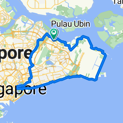
Event 2 Cycling Route Alternative Route (37km)
A cycling route starting in Singapore, Central Singapore Community Development Council, Singapore.
Overview
About this route
6 potential stations included for Amazing race
- -:--
- Duration
- 37.7 km
- Distance
- 104 m
- Ascent
- 101 m
- Descent
- ---
- Avg. speed
- ---
- Avg. speed
Route highlights
Points of interest along the route
Point of interest after 6.1 km
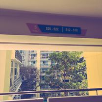
Station 2 (Cut off time 0000) TurnHouse Park Small area with a few exercise equipments
Point of interest after 10.7 km
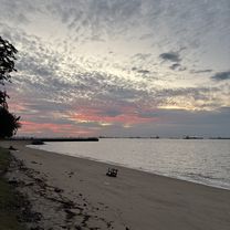
Station 3 (Cut off time 0100) 1st of 10 shelters along changi coast road
Point of interest after 16.8 km
Station 4 (Cut off time 0200) Last shelter along changi coast road
Point of interest after 23.1 km
Station 5 (cut off time 0300) East Coast Lagoon Food Village
Point of interest after 31.9 km
Station 6 (cut off time 0400) Empty plot of land beside bedok reservoir road
Continue with Bikemap
Use, edit, or download this cycling route
You would like to ride Event 2 Cycling Route Alternative Route (37km) or customize it for your own trip? Here is what you can do with this Bikemap route:
Free features
- Save this route as favorite or in collections
- Copy & plan your own version of this route
- Sync your route with Garmin or Wahoo
Premium features
Free trial for 3 days, or one-time payment. More about Bikemap Premium.
- Navigate this route on iOS & Android
- Export a GPX / KML file of this route
- Create your custom printout (try it for free)
- Download this route for offline navigation
Discover more Premium features.
Get Bikemap PremiumFrom our community
Other popular routes starting in Singapore
- Round Island (+TP1)
- Distance
- 155.6 km
- Ascent
- 1,028 m
- Descent
- 1,029 m
- Location
- Singapore, Central Singapore Community Development Council, Singapore
- SG RTI Clockwise Start ECP
- Distance
- 120.3 km
- Ascent
- 171 m
- Descent
- 168 m
- Location
- Singapore, Central Singapore Community Development Council, Singapore
- NorthernScenicExplorer
- Distance
- 38.8 km
- Ascent
- 177 m
- Descent
- 177 m
- Location
- Singapore, Central Singapore Community Development Council, Singapore
- RTI CHILL RIDE
- Distance
- 173.2 km
- Ascent
- 191 m
- Descent
- 197 m
- Location
- Singapore, Central Singapore Community Development Council, Singapore
- Tampines Simei Loop
- Distance
- 14.2 km
- Ascent
- 94 m
- Descent
- 91 m
- Location
- Singapore, Central Singapore Community Development Council, Singapore
- 6A Rhu Cross, Tanjong Rhu to 6A Rhu Cross, Tanjong Rhu
- Distance
- 14.5 km
- Ascent
- 113 m
- Descent
- 143 m
- Location
- Singapore, Central Singapore Community Development Council, Singapore
- 170C Punggol Field, Punggol to Punggol East, Punggol
- Distance
- 86 km
- Ascent
- 10 m
- Descent
- 30 m
- Location
- Singapore, Central Singapore Community Development Council, Singapore
- Tampines To Hyderabad/Kay Siang/Ridley Park
- Distance
- 58.1 km
- Ascent
- 477 m
- Descent
- 477 m
- Location
- Singapore, Central Singapore Community Development Council, Singapore
Open it in the app