

2017 / Közép-Zemplén
A cycling route starting in Tolcsva, Borsod-Abauj Zemplen county, Hungary.
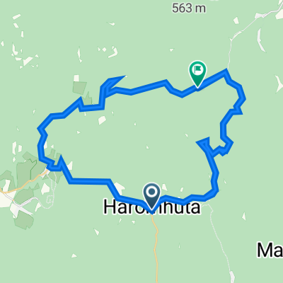
Overview
About this route
2017
- -:--
- Duration
- 116 km
- Distance
- 830 m
- Ascent
- 830 m
- Descent
- ---
- Avg. speed
- ---
- Max. altitude

Route quality
Waytypes & surfaces along the route
Waytypes
Busy road
75.9 km
(65 %)
Cycleway
17.7 km
(15 %)
Surfaces
Paved
35.8 km
(31 %)
Unpaved
2.5 km
(2 %)
Asphalt
35.6 km
(31 %)
Ground
2.2 km
(2 %)
Continue with Bikemap
Use, edit, or download this cycling route
You would like to ride 2017 / Közép-Zemplén or customize it for your own trip? Here is what you can do with this Bikemap route:
Free features
- Save this route as favorite or in collections
- Copy & plan your own version of this route
- Split it into stages to create a multi-day tour
- Sync your route with Garmin or Wahoo
Premium features
Free trial for 3 days, or one-time payment. More about Bikemap Premium.
- Navigate this route on iOS & Android
- Export a GPX / KML file of this route
- Create your custom printout (try it for free)
- Download this route for offline navigation
Discover more Premium features.
Get Bikemap PremiumFrom our community
Other popular routes starting in Tolcsva
 Zemplén 3. nap
- Distance
- 61.5 km
- Ascent
- 540 m
- Descent
- 540 m
- Location
- Tolcsva, Borsod-Abauj Zemplen county, Hungary
 Petőfi út 26, Háromhuta to Petőfi út 18, Háromhuta
- Distance
- 53.7 km
- Ascent
- 1,692 m
- Descent
- 1,715 m
- Location
- Tolcsva, Borsod-Abauj Zemplen county, Hungary
 Zempléni túra 2 nap
- Distance
- 85.2 km
- Ascent
- 547 m
- Descent
- 545 m
- Location
- Tolcsva, Borsod-Abauj Zemplen county, Hungary
 Kossuth út 22, Háromhuta to Petőfi út 3, Háromhuta
- Distance
- 22.6 km
- Ascent
- 820 m
- Descent
- 869 m
- Location
- Tolcsva, Borsod-Abauj Zemplen county, Hungary
 Zemplén karika
- Distance
- 63.6 km
- Ascent
- 516 m
- Descent
- 513 m
- Location
- Tolcsva, Borsod-Abauj Zemplen county, Hungary
 ozdsalgo
- Distance
- 174.8 km
- Ascent
- 768 m
- Descent
- 787 m
- Location
- Tolcsva, Borsod-Abauj Zemplen county, Hungary
 É-M.o/3
- Distance
- 96.7 km
- Ascent
- 107 m
- Descent
- 217 m
- Location
- Tolcsva, Borsod-Abauj Zemplen county, Hungary
 óhuta-kőkapu-regéc-óhuta
- Distance
- 49.9 km
- Ascent
- 1,096 m
- Descent
- 1,085 m
- Location
- Tolcsva, Borsod-Abauj Zemplen county, Hungary
Open it in the app