
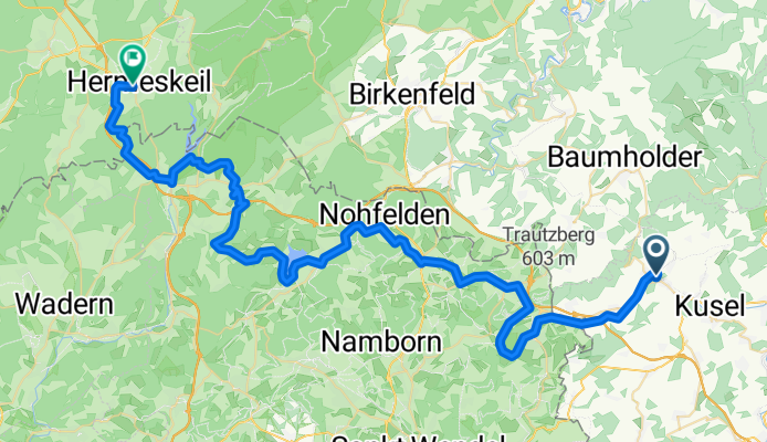
0619Ma: Thallichtenberg-Hermeskeil
A cycling route starting in Ruthweiler, Rhineland-Palatinate, Germany.
Overview
About this route
A:
E:
JH Hermeskeil
Adolf Kolping Str. 4
Hermeskeil
L/O € 55,00 HP € 72,00
- -:--
- Duration
- 64.5 km
- Distance
- 724 m
- Ascent
- 579 m
- Descent
- ---
- Avg. speed
- ---
- Max. altitude

Route quality
Waytypes & surfaces along the route
Waytypes
Track
26 km
(40 %)
Path
16.5 km
(26 %)
Surfaces
Paved
33.5 km
(52 %)
Unpaved
28 km
(43 %)
Asphalt
24.1 km
(37 %)
Loose gravel
13.3 km
(21 %)
Continue with Bikemap
Use, edit, or download this cycling route
You would like to ride 0619Ma: Thallichtenberg-Hermeskeil or customize it for your own trip? Here is what you can do with this Bikemap route:
Free features
- Save this route as favorite or in collections
- Copy & plan your own version of this route
- Sync your route with Garmin or Wahoo
Premium features
Free trial for 3 days, or one-time payment. More about Bikemap Premium.
- Navigate this route on iOS & Android
- Export a GPX / KML file of this route
- Create your custom printout (try it for free)
- Download this route for offline navigation
Discover more Premium features.
Get Bikemap PremiumFrom our community
Other popular routes starting in Ruthweiler
 0619Ma: Thallichtenberg-Hermeskeil
- Distance
- 64.5 km
- Ascent
- 724 m
- Descent
- 579 m
- Location
- Ruthweiler, Rhineland-Palatinate, Germany
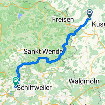
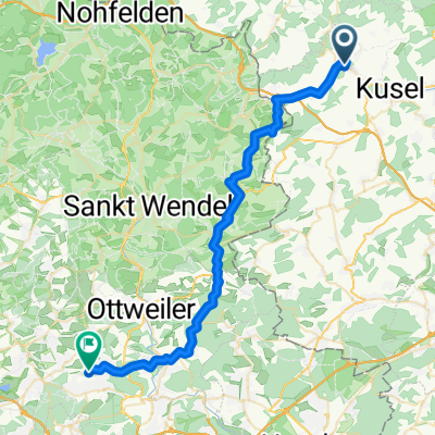 Von Thallichtenberg bis Schiffweiler
- Distance
- 39.7 km
- Ascent
- 741 m
- Descent
- 789 m
- Location
- Ruthweiler, Rhineland-Palatinate, Germany
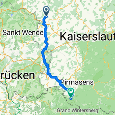 JHB Tallichtenberg nach Eppenbrunn
- Distance
- 73.4 km
- Ascent
- 701 m
- Descent
- 800 m
- Location
- Ruthweiler, Rhineland-Palatinate, Germany
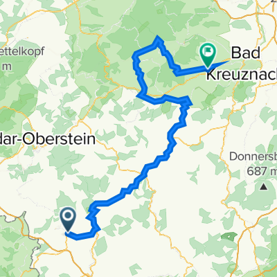
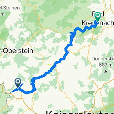 Burgstraße 14, Thallichtenberg nach Soonblick 2–8, Bad Kreuznach
- Distance
- 76.8 km
- Ascent
- 820 m
- Descent
- 944 m
- Location
- Ruthweiler, Rhineland-Palatinate, Germany
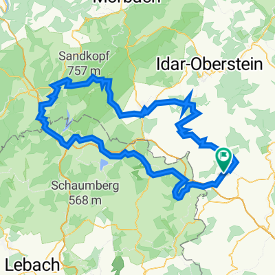 Hermeskeil - Saarlandrunde II
- Distance
- 117.6 km
- Ascent
- 1,980 m
- Descent
- 1,981 m
- Location
- Ruthweiler, Rhineland-Palatinate, Germany
 Dua Kusel
- Distance
- 14.3 km
- Ascent
- 351 m
- Descent
- 350 m
- Location
- Ruthweiler, Rhineland-Palatinate, Germany
 3.tag Burgstraße nach Schulstraße
- Distance
- 42.9 km
- Ascent
- 778 m
- Descent
- 847 m
- Location
- Ruthweiler, Rhineland-Palatinate, Germany
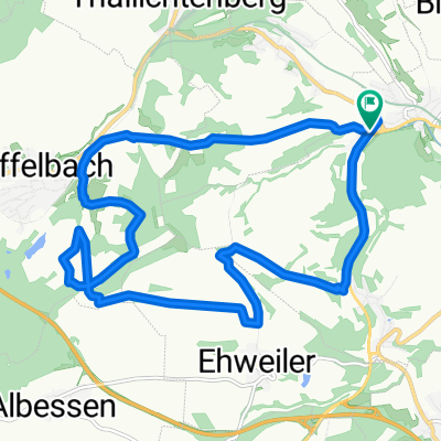
 Ruthweiler Radfahren
- Distance
- 93.2 km
- Ascent
- 391 m
- Descent
- 451 m
- Location
- Ruthweiler, Rhineland-Palatinate, Germany
Open it in the app