Kötschach-Mauthen - Sattendorf am Ossiachersee
A cycling route starting in Dellach, Carinthia, Austria.
Overview
About this route
Kötschach - Mauthen, Karnischer Cycling Path, Hermagor, Presseggersee, Nötsch, Erlendorf, Villach, Landskron, St. Andrä, Sattendorf at Lake Ossiach, Hotel Sonnenhügel
- -:--
- Duration
- 98.6 km
- Distance
- 96 m
- Ascent
- 268 m
- Descent
- ---
- Avg. speed
- ---
- Max. altitude
Route quality
Waytypes & surfaces along the route
Waytypes
Cycleway
41.4 km
(42 %)
Quiet road
17.7 km
(18 %)
Surfaces
Paved
64.1 km
(65 %)
Unpaved
10.8 km
(11 %)
Asphalt
61.1 km
(62 %)
Loose gravel
5.9 km
(6 %)
Continue with Bikemap
Use, edit, or download this cycling route
You would like to ride Kötschach-Mauthen - Sattendorf am Ossiachersee or customize it for your own trip? Here is what you can do with this Bikemap route:
Free features
- Save this route as favorite or in collections
- Copy & plan your own version of this route
- Split it into stages to create a multi-day tour
- Sync your route with Garmin or Wahoo
Premium features
Free trial for 3 days, or one-time payment. More about Bikemap Premium.
- Navigate this route on iOS & Android
- Export a GPX / KML file of this route
- Create your custom printout (try it for free)
- Download this route for offline navigation
Discover more Premium features.
Get Bikemap PremiumFrom our community
Other popular routes starting in Dellach
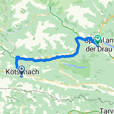
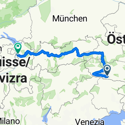
Von Kötschach-Mauthen bis Feldkirch- Distance
- 540.4 km
- Ascent
- 15,946 m
- Descent
- 16,181 m
- Location
- Dellach, Carinthia, Austria
nassfeld-tolmezzo- Distance
- 122.4 km
- Ascent
- 3,165 m
- Descent
- 3,165 m
- Location
- Dellach, Carinthia, Austria
Von Kötschach-Mauthen bis Spittal an der Drau- Distance
- 72.3 km
- Ascent
- 1,247 m
- Descent
- 1,417 m
- Location
- Dellach, Carinthia, Austria
AXS Tour de Alps 2009 - Stage 1°- Distance
- 78 km
- Ascent
- 2,365 m
- Descent
- 2,463 m
- Location
- Dellach, Carinthia, Austria
Kötschach - Bad Bleiberg- Distance
- 71 km
- Ascent
- 747 m
- Descent
- 536 m
- Location
- Dellach, Carinthia, Austria
2. Etapa- Distance
- 72.4 km
- Ascent
- 2,280 m
- Descent
- 2,380 m
- Location
- Dellach, Carinthia, Austria
zur Steinwenderhütte- Distance
- 12.6 km
- Ascent
- 1,146 m
- Descent
- 101 m
- Location
- Dellach, Carinthia, Austria
Kötschach 284a naar Kötschach 284a- Distance
- 20.1 km
- Ascent
- 306 m
- Descent
- 306 m
- Location
- Dellach, Carinthia, Austria
Open it in the app


