Bike Balkan - Variante Tirana
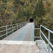
A cycling route starting in Kobilja Glava, Federation of Bosnia and Herzegovina, Bosnia and Herzegovina.
Overview
About this route
In the last part of the tour, an alternative route via Mavrovo National Park (without Tirana) is also conceivable.
The route includes almost all attractions that can still be reached with reasonable detours.
Day trip to Mount Lovcen with bikes optional, it is also possible by taxi/rental car.
The most direct way from Sarajevo to Durmitor National Park.
- -:--
- Duration
- 1,172 km
- Distance
- 8,736 m
- Ascent
- 8,458 m
- Descent
- ---
- Avg. speed
- ---
- Max. altitude
Continue with Bikemap
Use, edit, or download this cycling route
You would like to ride Bike Balkan - Variante Tirana or customize it for your own trip? Here is what you can do with this Bikemap route:
Free features
- Save this route as favorite or in collections
- Copy & plan your own version of this route
- Split it into stages to create a multi-day tour
- Sync your route with Garmin or Wahoo
Premium features
Free trial for 3 days, or one-time payment. More about Bikemap Premium.
- Navigate this route on iOS & Android
- Export a GPX / KML file of this route
- Create your custom printout (try it for free)
- Download this route for offline navigation
Discover more Premium features.
Get Bikemap PremiumFrom our community
Other popular routes starting in Kobilja Glava
- Сарајево - Манастир Високи Дечани - Охридско Езерo - Θεσσαλονίκη - Άγιον Όρος
- Distance
- 978.2 km
- Ascent
- 4,853 m
- Descent
- 5,409 m
- Location
- Kobilja Glava, Federation of Bosnia and Herzegovina, Bosnia and Herzegovina
- sarajevo-pale-sarajevo
- Distance
- 47.1 km
- Ascent
- 1,211 m
- Descent
- 1,237 m
- Location
- Kobilja Glava, Federation of Bosnia and Herzegovina, Bosnia and Herzegovina
- Dvorišta kijevo
- Distance
- 62.4 km
- Ascent
- 536 m
- Descent
- 1,095 m
- Location
- Kobilja Glava, Federation of Bosnia and Herzegovina, Bosnia and Herzegovina
- Сарајево - Θεσσαλονίκη
- Distance
- 914.1 km
- Ascent
- 6,076 m
- Descent
- 6,593 m
- Location
- Kobilja Glava, Federation of Bosnia and Herzegovina, Bosnia and Herzegovina
- CRITERIUM PAUL LOWE 2025
- Distance
- 0.9 km
- Ascent
- 0 m
- Descent
- 0 m
- Location
- Kobilja Glava, Federation of Bosnia and Herzegovina, Bosnia and Herzegovina
- Asphalt_02: Muzej - Dariva - Zmajevac - Chavljak - Sedrenik - Bjelave - Babaloo
- Distance
- 23.5 km
- Ascent
- 683 m
- Descent
- 677 m
- Location
- Kobilja Glava, Federation of Bosnia and Herzegovina, Bosnia and Herzegovina
- Asphalt_01: Dariva - Vrelo Bosne
- Distance
- 25 km
- Ascent
- 286 m
- Descent
- 317 m
- Location
- Kobilja Glava, Federation of Bosnia and Herzegovina, Bosnia and Herzegovina
- Breka - Ilidza - Igman - Hadzici - Blazuj - Ilidza - Breka
- Distance
- 78.8 km
- Ascent
- 2,020 m
- Descent
- 2,011 m
- Location
- Kobilja Glava, Federation of Bosnia and Herzegovina, Bosnia and Herzegovina
Open it in the app