Tam to K dDuc
A cycling route starting in Hoi An, Quảng Nam Province, Vietnam.
Overview
About this route
- -:--
- Duration
- 133.5 km
- Distance
- 815 m
- Ascent
- 453 m
- Descent
- ---
- Avg. speed
- ---
- Max. altitude
Continue with Bikemap
Use, edit, or download this cycling route
You would like to ride Tam to K dDuc or customize it for your own trip? Here is what you can do with this Bikemap route:
Free features
- Save this route as favorite or in collections
- Copy & plan your own version of this route
- Split it into stages to create a multi-day tour
- Sync your route with Garmin or Wahoo
Premium features
Free trial for 3 days, or one-time payment. More about Bikemap Premium.
- Navigate this route on iOS & Android
- Export a GPX / KML file of this route
- Create your custom printout (try it for free)
- Download this route for offline navigation
Discover more Premium features.
Get Bikemap PremiumFrom our community
Other popular routes starting in Hoi An
Tam to K dDuc- Distance
- 133.5 km
- Ascent
- 815 m
- Descent
- 453 m
- Location
- Hoi An, Quảng Nam Province, Vietnam
23-1-033.00_HoiAn_DaNang_33km- Distance
- 32.9 km
- Ascent
- 104 m
- Descent
- 102 m
- Location
- Hoi An, Quảng Nam Province, Vietnam
hoian- Distance
- 3.7 km
- Ascent
- 8 m
- Descent
- 12 m
- Location
- Hoi An, Quảng Nam Province, Vietnam
camkim- Distance
- 19.5 km
- Ascent
- 51 m
- Descent
- 54 m
- Location
- Hoi An, Quảng Nam Province, Vietnam
cam kim- Distance
- 19.5 km
- Ascent
- 31 m
- Descent
- 34 m
- Location
- Hoi An, Quảng Nam Province, Vietnam
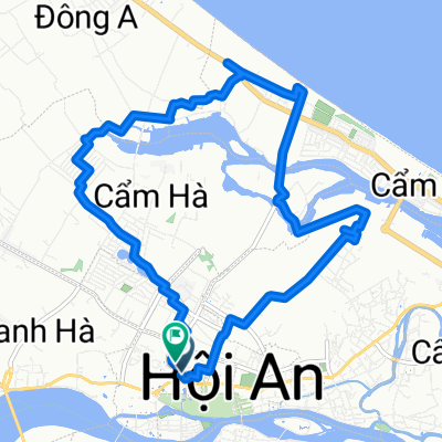
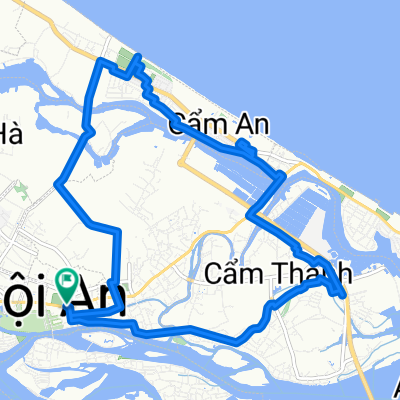
Hoi An Afternoon Bike Tour (Relaxed)- Distance
- 17.3 km
- Ascent
- 49 m
- Descent
- 50 m
- Location
- Hoi An, Quảng Nam Province, Vietnam
7) Hoi An - My Lai - Quang Ngai- Distance
- 132.3 km
- Ascent
- 124 m
- Descent
- 130 m
- Location
- Hoi An, Quảng Nam Province, Vietnam
20130122_Hoi An - Phu Bai- Distance
- 121.5 km
- Ascent
- 574 m
- Descent
- 579 m
- Location
- Hoi An, Quảng Nam Province, Vietnam
Open it in the app

