

Potenzieller Radfernweg Berlin-Breslau
A cycling route starting in Tiergarten, State of Berlin, Germany.
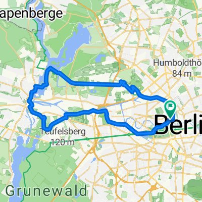
Overview
About this route
Erster Entwurf einer Route von Berlin nach Breslau (Wroclaw) im Rahmen einer Abschlussarbeit an der HNE Eberswalde. Die Route folgt hauptsächlich dem Spreeradweg (bis Beeskow), der Oder-Spree-Tour (bis Neuzelle) und dem Oder Radweg (bis Breslau) auf polnischer Seite.
- -:--
- Duration
- 506.5 km
- Distance
- 432 m
- Ascent
- 346 m
- Descent
- ---
- Avg. speed
- ---
- Max. altitude
Route quality
Waytypes & surfaces along the route
Waytypes
Track
116.5 km
(23 %)
Road
111.4 km
(22 %)
Surfaces
Paved
339.4 km
(67 %)
Unpaved
65.8 km
(13 %)
Asphalt
319.1 km
(63 %)
Gravel
30.4 km
(6 %)
Continue with Bikemap
Use, edit, or download this cycling route
You would like to ride Potenzieller Radfernweg Berlin-Breslau or customize it for your own trip? Here is what you can do with this Bikemap route:
Free features
- Save this route as favorite or in collections
- Copy & plan your own version of this route
- Split it into stages to create a multi-day tour
- Sync your route with Garmin or Wahoo
Premium features
Free trial for 3 days, or one-time payment. More about Bikemap Premium.
- Navigate this route on iOS & Android
- Export a GPX / KML file of this route
- Create your custom printout (try it for free)
- Download this route for offline navigation
Discover more Premium features.
Get Bikemap PremiumFrom our community
Other popular routes starting in Tiergarten
 Mauerradweg
- Distance
- 171.7 km
- Ascent
- 169 m
- Descent
- 171 m
- Location
- Tiergarten, State of Berlin, Germany
 Hollys-Galeriecafe
- Distance
- 110 km
- Ascent
- 108 m
- Descent
- 111 m
- Location
- Tiergarten, State of Berlin, Germany
 Kleine Parlamentarische Fahrradtour 2018
- Distance
- 8.8 km
- Ascent
- 56 m
- Descent
- 54 m
- Location
- Tiergarten, State of Berlin, Germany
 2014 Skoda Velothon Berlin 120 km
- Distance
- 117.7 km
- Ascent
- 173 m
- Descent
- 175 m
- Location
- Tiergarten, State of Berlin, Germany
 Die Route fürs Alleycat/Groupride
- Distance
- 144.4 km
- Ascent
- 304 m
- Descent
- 252 m
- Location
- Tiergarten, State of Berlin, Germany
 Trainingsstrecke "aktivcenter"
- Distance
- 45.6 km
- Ascent
- 152 m
- Descent
- 152 m
- Location
- Tiergarten, State of Berlin, Germany
 Velothon 2009
- Distance
- 122.7 km
- Ascent
- 272 m
- Descent
- 274 m
- Location
- Tiergarten, State of Berlin, Germany
 Spree,Havel und Hohenzollernkanal
- Distance
- 33.2 km
- Ascent
- 35 m
- Descent
- 35 m
- Location
- Tiergarten, State of Berlin, Germany
Open it in the app