

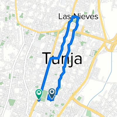
Al Puente De Boyaca
A cycling route starting in Tunja, Departamento de Boyacá, Colombia.
Overview
About this route
- -:--
- Duration
- 38.5 km
- Distance
- 805 m
- Ascent
- 805 m
- Descent
- ---
- Avg. speed
- ---
- Max. altitude

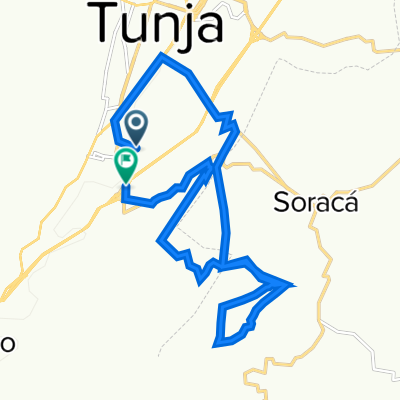
Route photos


Continue with Bikemap
Use, edit, or download this cycling route
You would like to ride Al Puente De Boyaca or customize it for your own trip? Here is what you can do with this Bikemap route:
Free features
- Save this route as favorite or in collections
- Copy & plan your own version of this route
- Sync your route with Garmin or Wahoo
Premium features
Free trial for 3 days, or one-time payment. More about Bikemap Premium.
- Navigate this route on iOS & Android
- Export a GPX / KML file of this route
- Create your custom printout (try it for free)
- Download this route for offline navigation
Discover more Premium features.
Get Bikemap PremiumFrom our community
Other popular routes starting in Tunja
 Al Puente De Boyaca
- Distance
- 38.5 km
- Ascent
- 805 m
- Descent
- 805 m
- Location
- Tunja, Departamento de Boyacá, Colombia
 De Carrera 1a Este, Tunja a Avenida Universitaria 40-28, Tunja
- Distance
- 23.6 km
- Ascent
- 345 m
- Descent
- 357 m
- Location
- Tunja, Departamento de Boyacá, Colombia
 Sachica
- Distance
- 64.2 km
- Ascent
- 1,367 m
- Descent
- 1,355 m
- Location
- Tunja, Departamento de Boyacá, Colombia
 De Carrera 9a 14-06, Tunja a Calle 13 10-91, Tunja
- Distance
- 5.5 km
- Ascent
- 56 m
- Descent
- 55 m
- Location
- Tunja, Departamento de Boyacá, Colombia
 la granja
- Distance
- 14.1 km
- Ascent
- 334 m
- Descent
- 333 m
- Location
- Tunja, Departamento de Boyacá, Colombia
 Tunja enduro
- Distance
- 20.1 km
- Ascent
- 670 m
- Descent
- 666 m
- Location
- Tunja, Departamento de Boyacá, Colombia
 De Calle 1 A Sur 5-8, Tunja a Calle 1 A Sur 5-8, Tunja
- Distance
- 89.4 km
- Ascent
- 1,475 m
- Descent
- 1,526 m
- Location
- Tunja, Departamento de Boyacá, Colombia
 Tunja-Motavita
- Distance
- 6.9 km
- Ascent
- 229 m
- Descent
- 209 m
- Location
- Tunja, Departamento de Boyacá, Colombia
Open it in the app