

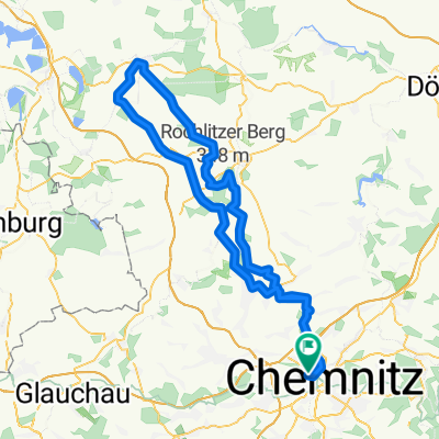
DM im Straßenradsport 2017 - Rundkurs
A cycling route starting in Chemnitz, Saxony, Germany.
Overview
About this route
Deutsche Meisterschaften im Straßenradsport vom 23. bis 25. Juni 2017 in Chemnitz. Der Rundkurs ist beim Straßenrennen der Männer und Frauen zu absolvieren.
Weitere Informationen zur DM unter www.dm-rad2017.de
- -:--
- Duration
- 19.1 km
- Distance
- 213 m
- Ascent
- 210 m
- Descent
- ---
- Avg. speed
- ---
- Max. altitude

Route quality
Waytypes & surfaces along the route
Waytypes
Quiet road
5.2 km
(27 %)
Busy road
4.9 km
(26 %)
Surfaces
Paved
17.2 km
(90 %)
Unpaved
0.3 km
(2 %)
Asphalt
15.4 km
(80 %)
Paved (undefined)
0.9 km
(5 %)
Continue with Bikemap
Use, edit, or download this cycling route
You would like to ride DM im Straßenradsport 2017 - Rundkurs or customize it for your own trip? Here is what you can do with this Bikemap route:
Free features
- Save this route as favorite or in collections
- Copy & plan your own version of this route
- Sync your route with Garmin or Wahoo
Premium features
Free trial for 3 days, or one-time payment. More about Bikemap Premium.
- Navigate this route on iOS & Android
- Export a GPX / KML file of this route
- Create your custom printout (try it for free)
- Download this route for offline navigation
Discover more Premium features.
Get Bikemap PremiumFrom our community
Other popular routes starting in Chemnitz
 Chemnitz - Rochlitzer Berg - Bad Lausick - Chemnitz 2
- Distance
- 108.4 km
- Ascent
- 546 m
- Descent
- 543 m
- Location
- Chemnitz, Saxony, Germany
 Chemnitz Küchwald - Kriebstein und zurück
- Distance
- 71.5 km
- Ascent
- 567 m
- Descent
- 567 m
- Location
- Chemnitz, Saxony, Germany
 West- Nord- Runde (Grüna, Glöse, ...)
- Distance
- 49.8 km
- Ascent
- 339 m
- Descent
- 339 m
- Location
- Chemnitz, Saxony, Germany
 4h Runde Chemnitz
- Distance
- 107.7 km
- Ascent
- 582 m
- Descent
- 572 m
- Location
- Chemnitz, Saxony, Germany
 Zschopextreme
- Distance
- 47.7 km
- Ascent
- 675 m
- Descent
- 677 m
- Location
- Chemnitz, Saxony, Germany
 Chemnitz - Kohren Salis
- Distance
- 96.3 km
- Ascent
- 522 m
- Descent
- 526 m
- Location
- Chemnitz, Saxony, Germany
 Raben-Toten-Hohen-stein-Runde
- Distance
- 41.4 km
- Ascent
- 393 m
- Descent
- 397 m
- Location
- Chemnitz, Saxony, Germany
 Goldner Hahn _ Wasserschloß
- Distance
- 34.3 km
- Ascent
- 670 m
- Descent
- 675 m
- Location
- Chemnitz, Saxony, Germany
Open it in the app