

Alpské průsmyky a jezera na kole
A cycling route starting in Nauders, Tyrol, Austria.
Overview
About this route
Unique locations in the Swiss and Italian Alps, mountain passes with fantastic scenery, enhanced by challenging kilometers in the saddle for true cycling enthusiasts.
- -:--
- Duration
- 487.6 km
- Distance
- 8,111 m
- Ascent
- 7,981 m
- Descent
- ---
- Avg. speed
- ---
- Max. altitude

Route quality
Waytypes & surfaces along the route
Waytypes
Track
97.5 km
(20 %)
Road
58.5 km
(12 %)
Surfaces
Paved
346.2 km
(71 %)
Unpaved
82.9 km
(17 %)
Asphalt
331.6 km
(68 %)
Gravel
53.6 km
(11 %)
Route highlights
Points of interest along the route
Point of interest after 0.4 km
odtud na kole podél řeky Inn do Švýcarska do Davosu
Point of interest after 26.7 km
lázeňské městečko Scuol, dále na kole do Davosu
Point of interest after 170.5 km
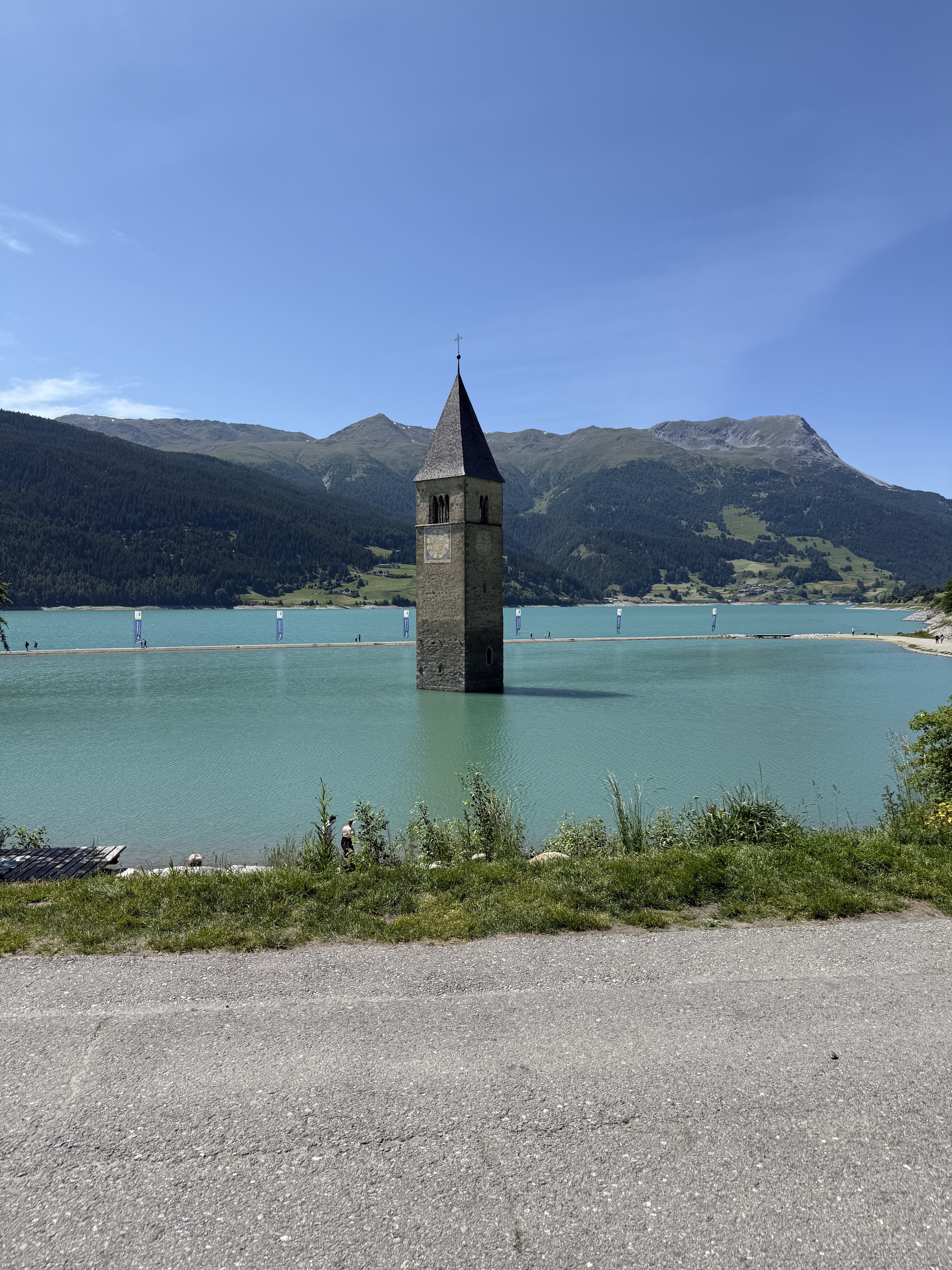
2. nejvyšší švýcarský průsmyk Stelvio
Point of interest after 191.6 km
Bormio
Point of interest after 223.4 km
lyžařské středisko Livigno
Point of interest after 259.6 km
světoznámé středisko sportů St. Moritz
Point of interest after 335 km
rétorománské středisko Švýcarska - Chur, odtud busem do Davos
Point of interest after 395 km
Davos - nejluxusnější švýcarské středisko
Point of interest after 425.5 km
Tiefelcastel
Point of interest after 452.1 km
Albula
Point of interest after 487.3 km
Zernez, poslední den zpět do ČR
Continue with Bikemap
Use, edit, or download this cycling route
You would like to ride Alpské průsmyky a jezera na kole or customize it for your own trip? Here is what you can do with this Bikemap route:
Free features
- Save this route as favorite or in collections
- Copy & plan your own version of this route
- Split it into stages to create a multi-day tour
- Sync your route with Garmin or Wahoo
Premium features
Free trial for 3 days, or one-time payment. More about Bikemap Premium.
- Navigate this route on iOS & Android
- Export a GPX / KML file of this route
- Create your custom printout (try it for free)
- Download this route for offline navigation
Discover more Premium features.
Get Bikemap PremiumFrom our community
Other popular routes starting in Nauders
 Fuhrmannsloch, Nauders nach Reschenstraße, Nauders
- Distance
- 43.6 km
- Ascent
- 613 m
- Descent
- 643 m
- Location
- Nauders, Tyrol, Austria
 Pfunds - Graun
- Distance
- 54 km
- Ascent
- 788 m
- Descent
- 1,424 m
- Location
- Nauders, Tyrol, Austria
 3 Ländertour die Uina-Schlucht hoch
- Distance
- 73.6 km
- Ascent
- 1,822 m
- Descent
- 1,822 m
- Location
- Nauders, Tyrol, Austria
 Via Claudia Augusta 08-2025
- Distance
- 85.5 km
- Ascent
- 792 m
- Descent
- 1,907 m
- Location
- Nauders, Tyrol, Austria
 Plamort Trail
- Distance
- 5.5 km
- Ascent
- 58 m
- Descent
- 672 m
- Location
- Nauders, Tyrol, Austria
 Nauders, Nauders nach Passerpromenade, Meran
- Distance
- 104.1 km
- Ascent
- 966 m
- Descent
- 2,021 m
- Location
- Nauders, Tyrol, Austria
 Rundwanderung Grosserßer Mutzkopf to Via Roma
- Distance
- 293 km
- Ascent
- 3,259 m
- Descent
- 4,972 m
- Location
- Nauders, Tyrol, Austria
 Von Nauders bis Menaggio
- Distance
- 80.8 km
- Ascent
- 3,585 m
- Descent
- 3,727 m
- Location
- Nauders, Tyrol, Austria
Open it in the app