

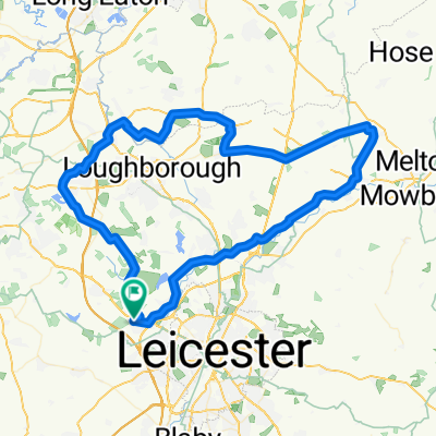
Moira and National Forest
A cycling route starting in Glenfield, England, United Kingdom.
Overview
About this route
41.6 miles
- -:--
- Duration
- 67 km
- Distance
- 417 m
- Ascent
- 418 m
- Descent
- ---
- Avg. speed
- ---
- Max. altitude

Continue with Bikemap
Use, edit, or download this cycling route
You would like to ride Moira and National Forest or customize it for your own trip? Here is what you can do with this Bikemap route:
Free features
- Save this route as favorite or in collections
- Copy & plan your own version of this route
- Sync your route with Garmin or Wahoo
Premium features
Free trial for 3 days, or one-time payment. More about Bikemap Premium.
- Navigate this route on iOS & Android
- Export a GPX / KML file of this route
- Create your custom printout (try it for free)
- Download this route for offline navigation
Discover more Premium features.
Get Bikemap PremiumFrom our community
Other popular routes starting in Glenfield
 29/7 Ride
- Distance
- 80.3 km
- Ascent
- 389 m
- Descent
- 388 m
- Location
- Glenfield, England, United Kingdom
 Route #3
- Distance
- 38.3 km
- Ascent
- 407 m
- Descent
- 407 m
- Location
- Glenfield, England, United Kingdom
 Daisy’s Tearooms 🍰☕️
- Distance
- 22.5 km
- Ascent
- 109 m
- Descent
- 107 m
- Location
- Glenfield, England, United Kingdom
 20140615_170134.gpx
- Distance
- 32.3 km
- Ascent
- 237 m
- Descent
- 236 m
- Location
- Glenfield, England, United Kingdom
 Usual Run
- Distance
- 9.5 km
- Ascent
- 64 m
- Descent
- 63 m
- Location
- Glenfield, England, United Kingdom
 C2C Training Route 19/4
- Distance
- 42.4 km
- Ascent
- 354 m
- Descent
- 357 m
- Location
- Glenfield, England, United Kingdom
 29/10 Cafe Ventoux
- Distance
- 86 km
- Ascent
- 423 m
- Descent
- 423 m
- Location
- Glenfield, England, United Kingdom
 Groby to Cafe Ventoux
- Distance
- 56 km
- Ascent
- 314 m
- Descent
- 229 m
- Location
- Glenfield, England, United Kingdom
Open it in the app