

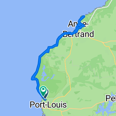
Port-Louis - Petit-Canal - Gros Cap - Anse-Bertrand - Port-Louis 70km 280m
A cycling route starting in Port-Louis, Guadeloupe, Guadeloupe.
Overview
About this route
- -:--
- Duration
- 68.5 km
- Distance
- 209 m
- Ascent
- 209 m
- Descent
- ---
- Avg. speed
- ---
- Max. altitude

Route quality
Waytypes & surfaces along the route
Waytypes
Busy road
30.3 km
(44 %)
Road
22.8 km
(33 %)
Surfaces
Paved
60.2 km
(88 %)
Unpaved
4.8 km
(7 %)
Asphalt
60.2 km
(88 %)
Unpaved (undefined)
4.6 km
(7 %)
Continue with Bikemap
Use, edit, or download this cycling route
You would like to ride Port-Louis - Petit-Canal - Gros Cap - Anse-Bertrand - Port-Louis 70km 280m or customize it for your own trip? Here is what you can do with this Bikemap route:
Free features
- Save this route as favorite or in collections
- Copy & plan your own version of this route
- Sync your route with Garmin or Wahoo
Premium features
Free trial for 3 days, or one-time payment. More about Bikemap Premium.
- Navigate this route on iOS & Android
- Export a GPX / KML file of this route
- Create your custom printout (try it for free)
- Download this route for offline navigation
Discover more Premium features.
Get Bikemap PremiumFrom our community
Other popular routes starting in Port-Louis
 De Rue Éric Williams à Just Guingadarin
- Distance
- 21.2 km
- Ascent
- 502 m
- Descent
- 477 m
- Location
- Port-Louis, Guadeloupe, Guadeloupe
 Glp Port-Luis nach Petit-Bourg
- Distance
- 46.6 km
- Ascent
- 202 m
- Descent
- 186 m
- Location
- Port-Louis, Guadeloupe, Guadeloupe
 Port-Louis - Petit-Canal - Gros Cap - Anse-Bertrand - Port-Louis 70km 280m
- Distance
- 68.5 km
- Ascent
- 209 m
- Descent
- 209 m
- Location
- Port-Louis, Guadeloupe, Guadeloupe
Open it in the app